MyTopo
Goddards Peak Washington US Topo Map
Couldn't load pickup availability
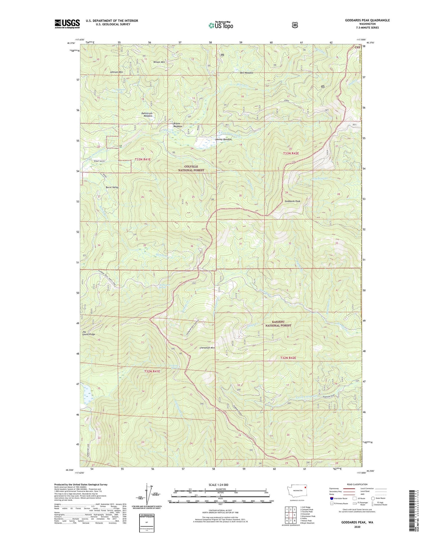
2020 topographic map quadrangle Goddards Peak in the state of Washington. Scale: 1:24000. Based on the newly updated USGS 7.5' US Topo map series, this map is in the following counties: Stevens, Pend Oreille. The map contains contour data, water features, and other items you are used to seeing on USGS maps, but also has updated roads and other features. This is the next generation of topographic maps. Printed on high-quality waterproof paper with UV fade-resistant inks.
Quads adjacent to this one:
West: Chewelah
Northwest: Cliff Ridge
North: Calispell Peak
Northeast: Tacoma Peak
East: Winchester Peak
Southeast: Boyer Mountain
South: Nelson Peak
Southwest: Valley
Contains the following named places: Bell Meadow, Bisbee Meadow, Chewelah Mountain, Dahlstrom Meadow, Donaldson Creek, Forty Nine Degrees North Ski Area, Goddards Peak, Healey Creek, Healey Meadow, Horseshoe Lake, Jay Gould Ridge, Johnson Lake, Johnson Mountain, Little Calispell Creek, Lookout Spring, McPherson Spring, Nelson Creek, Palmer Creek, Wilson Creek, Wilson Mountain