MyTopo
Nelson Peak Washington US Topo Map
Couldn't load pickup availability
Also explore the Nelson Peak Forest Service Topo of this same quad for updated USFS data
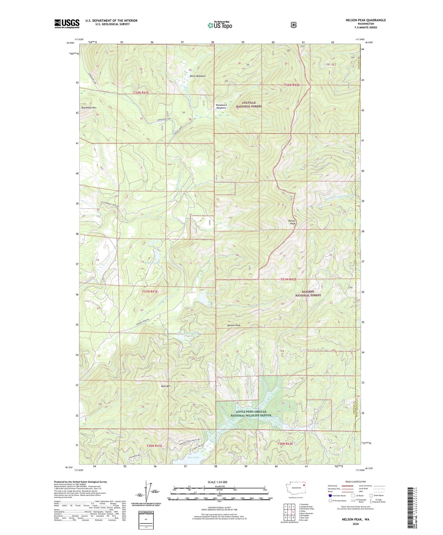
2023 topographic map quadrangle Nelson Peak in the state of Washington. Scale: 1:24000. Based on the newly updated USGS 7.5' US Topo map series, this map is in the following counties: Stevens, Pend Oreille. The map contains contour data, water features, and other items you are used to seeing on USGS maps, but also has updated roads and other features. This is the next generation of topographic maps. Printed on high-quality waterproof paper with UV fade-resistant inks.
Quads adjacent to this one:
West: Valley
Northwest: Chewelah
North: Goddards Peak
Northeast: Winchester Peak
East: Boyer Mountain
Southeast: Fan Lake
South: Deer Lake
Southwest: Springdale
This map covers the same area as the classic USGS quad with code o48117b5.
Contains the following named places: Bald Mountain, Benson Lake, Benson Peak, Betts Meadows, Buzzard Lake, Camp Hafer, Kaniksu Ranch, Nelson Lake, Nelson Peak, Roundtop Mountain, Woodward Meadows