MyTopo
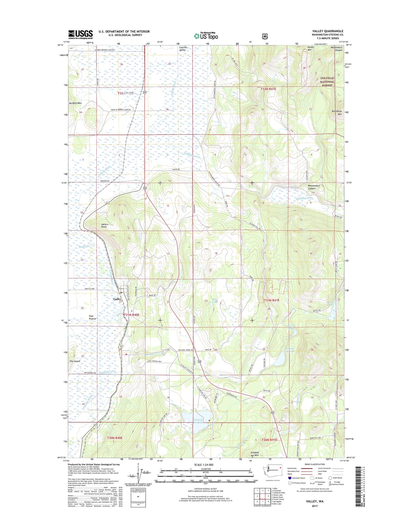
Valley Washington US Topo Map
Couldn't load pickup availability
Also explore the Valley Forest Service Topo of this same quad for updated USFS data
2023 topographic map quadrangle Valley in the state of Washington. Scale: 1:24000. Based on the newly updated USGS 7.5' US Topo map series, this map is in the following counties: Stevens. The map contains contour data, water features, and other items you are used to seeing on USGS maps, but also has updated roads and other features. This is the next generation of topographic maps. Printed on high-quality waterproof paper with UV fade-resistant inks.
Quads adjacent to this one:
West: Waitts Lake
Northwest: Addy
North: Chewelah
Northeast: Goddards Peak
East: Nelson Peak
Southeast: Deer Lake
South: Springdale
Southwest: Forest Center
This map covers the same area as the classic USGS quad with code o48117b6.
Contains the following named places: Beitey Lake, Beitey Lake Dam, Blue Bird Mine, Blue Lake, Bulldog Creek, Cottonwood Creek, Fool Prairie, Franzwa Creek, Grouse Creek, Hirsch Pond, Holy Ghost Catholic Church, Huckleberry Creek, Inklers Point, Jumpoff Jim Lake, Jumpoff Jim Lake Dam, Jumpoff Joe Creek, Jumpoff Joe Lake, Kulzer, Pinegrove Mennonite Church, Sherwood Creek, Stevens County Fire District 4 Station 41- Valley, Valley, Valley Bible Church, Valley Census Designated Place, Valley Elementary School, Valley Post Office, Valley School, Waitts Creek, Wessendorf Canyon