MyTopo
Dayton Washington US Topo Map
Couldn't load pickup availability
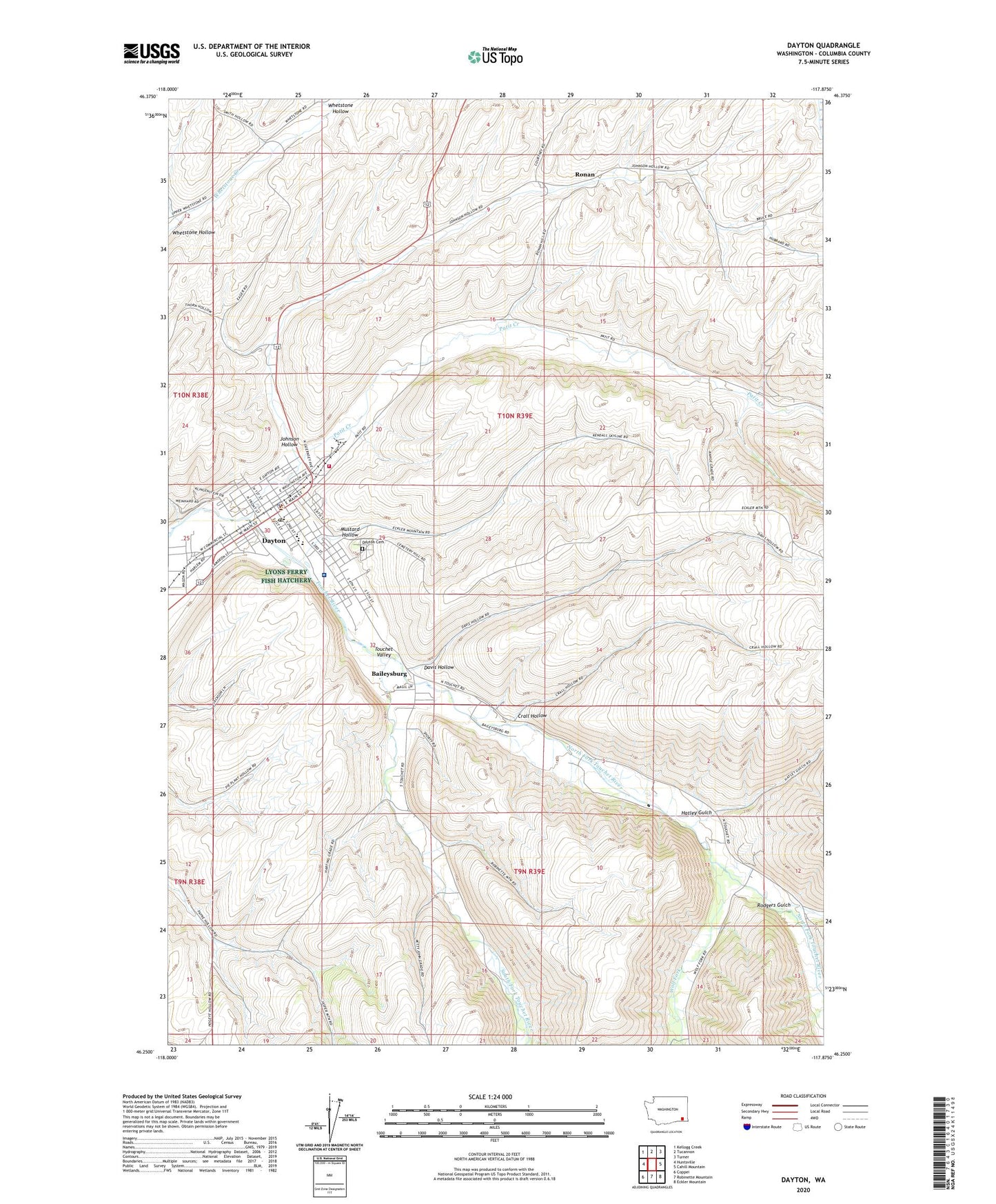
2023 topographic map quadrangle Dayton in the state of Washington. Scale: 1:24000. Based on the newly updated USGS 7.5' US Topo map series, this map is in the following counties: Columbia. The map contains contour data, water features, and other items you are used to seeing on USGS maps, but also has updated roads and other features. This is the next generation of topographic maps. Printed on high-quality waterproof paper with UV fade-resistant inks.
Quads adjacent to this one:
West: Huntsville
Northwest: Kellogg Creek
North: Tucannon
Northeast: Turner
East: Cahill Mountain
Southeast: Eckler Mountain
South: Robinette Mountain
Southwest: Coppei
This map covers the same area as the classic USGS quad with code o46117c8.
Contains the following named places: Baileysburg, City of Dayton, Columbia County, Columbia County Courthouse, Columbia County Fire District 3, Columbia County Sheriff's Office, Crall Hollow, Davis Hollow, Dayton, Dayton and Columbia County Fairgrounds, Dayton Cemetery, Dayton Elementary School, Dayton General Hospital, Dayton High School, Dayton Post Office, Dayton Railroad Depot, Hatley Gulch, Johnson Hollow, KZHR-FM (Dayton), Mustard Hollow, North Fork Touchet River, Patit Creek, Rodgers Gulch, Ronan, South Fork Touchet River, Thorn Lookout Tower, Touchet Valley Golf Course, Wolf Fork