MyTopo
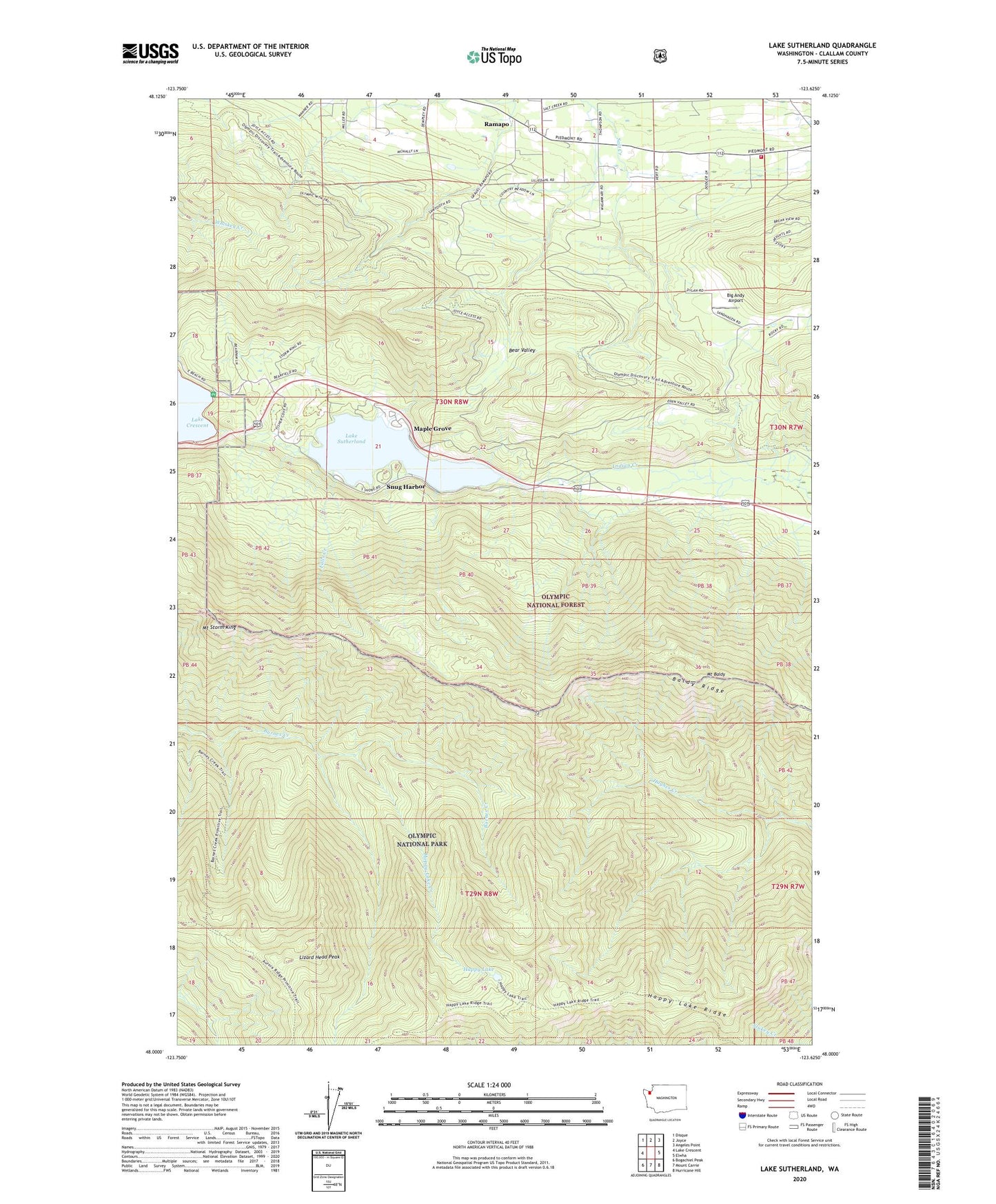
Lake Sutherland Washington US Topo Map
Couldn't load pickup availability
Also explore the Lake Sutherland Forest Service Topo of this same quad for updated USFS data
2023 topographic map quadrangle Lake Sutherland in the state of Washington. Scale: 1:24000. Based on the newly updated USGS 7.5' US Topo map series, this map is in the following counties: Clallam. The map contains contour data, water features, and other items you are used to seeing on USGS maps, but also has updated roads and other features. This is the next generation of topographic maps. Printed on high-quality waterproof paper with UV fade-resistant inks.
Quads adjacent to this one:
West: Lake Crescent
Northwest: Disque
North: Joyce
Northeast: Angeles Point
East: Elwha
Southeast: Hurricane Hill
South: Mount Carrie
Southwest: Bogachiel Peak
This map covers the same area as the classic USGS quad with code o48123a6.
Contains the following named places: Baldy Ridge, Bear Valley, Big Andy Airport, Clallam County Fire District 2 Station 24 - Shadow Mountain, Clallam County Fire Protection District, East Beach, East Beach Picnic Area, Falls Creek, Happy Lake, Happy Lake Creek, Happy Lake Ridge, Happy Lake Ridge Trail, Lake Sutherland, Lizard Head Peak, Maple Grove, Mount Baldy, Mount Storm King, Ramapo, Shadow Mountain Recreational Vehicle Park, Snug Harbor