MyTopo
Independent Mountain Washington US Topo Map
Couldn't load pickup availability
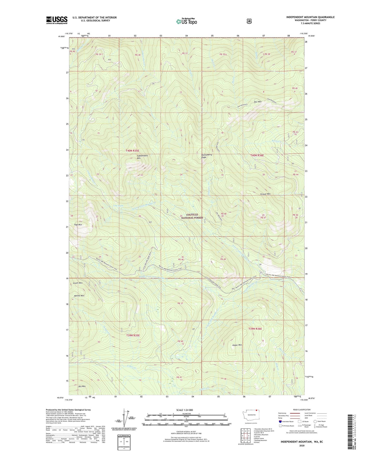
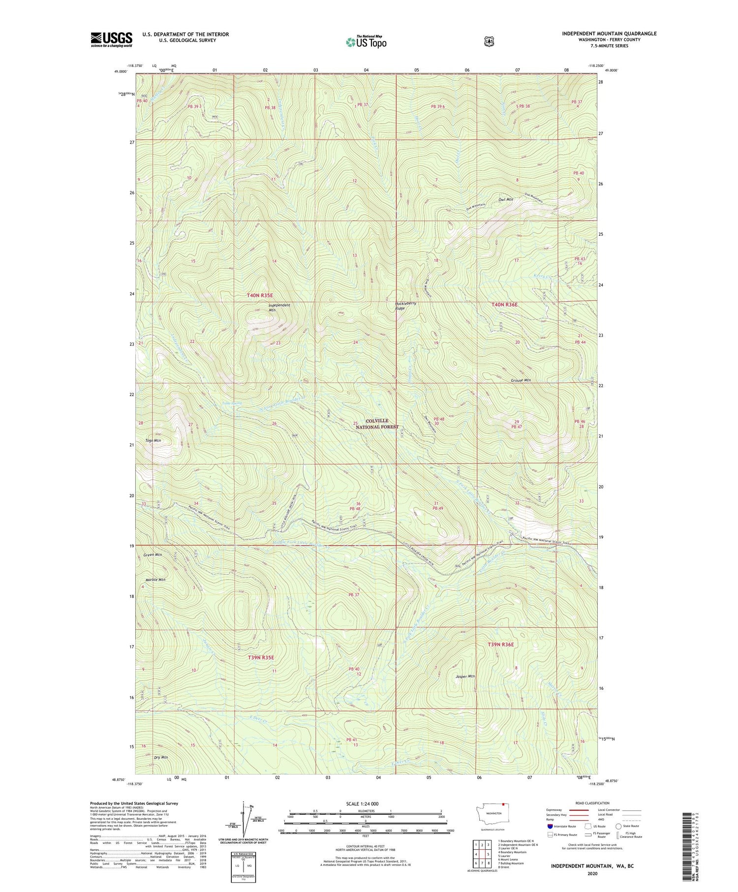
2020 topographic map quadrangle Independent Mountain in the state of Washington. Scale: 1:24000. Based on the newly updated USGS 7.5' US Topo map series, this map is in the following counties: Ferry. The map contains contour data, water features, and other items you are used to seeing on USGS maps, but also has updated roads and other features. This is the next generation of topographic maps. Printed on high-quality waterproof paper with UV fade-resistant inks.
Quads adjacent to this one:
West: Boundary Mountain
Northwest: Boundary Mountain OE N
North: Independent Mountain OE N
Northeast: Laurier OE N
East: Laurier
Southeast: Orient
South: Bulldog Mountain
Southwest: Mount Leona
Contains the following named places: Green Mountain, Grouse Mountain, Huckleberry Ridge, Independent Mountain, Jasper Mountain, Jungle Creek, Manley Creek, Middle Fork Little Boulder Creek, North Fork Little Boulder Creek, Onion Creek, Owl Mountain, South Fork Little Boulder Creek, Table Spring, Togo Mountain, ZIP Code: 99146