MyTopo
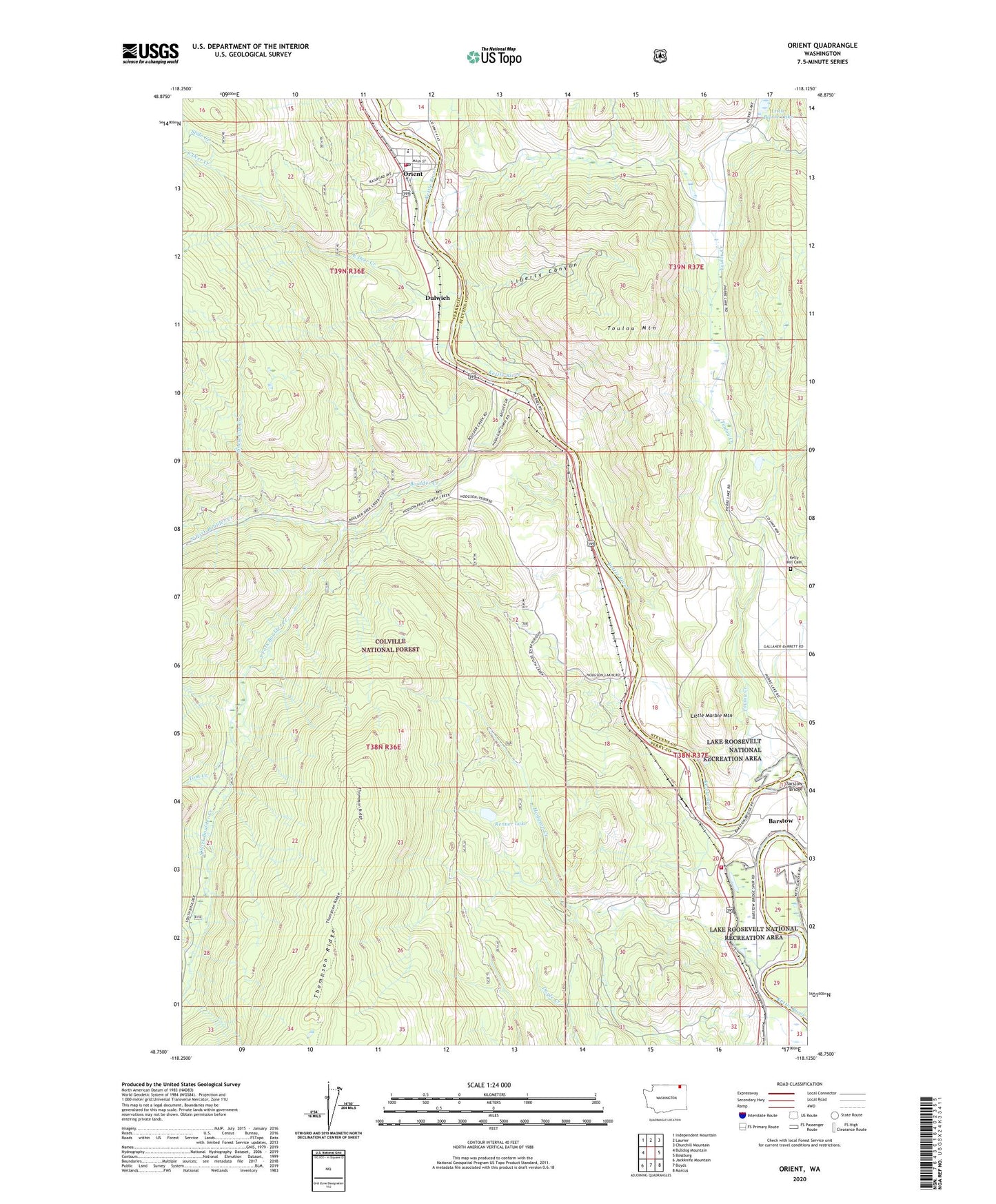
Orient Washington US Topo Map
Couldn't load pickup availability
Also explore the Orient Forest Service Topo of this same quad for updated USFS data
2023 topographic map quadrangle Orient in the state of Washington. Scale: 1:24000. Based on the newly updated USGS 7.5' US Topo map series, this map is in the following counties: Ferry, Stevens. The map contains contour data, water features, and other items you are used to seeing on USGS maps, but also has updated roads and other features. This is the next generation of topographic maps. Printed on high-quality waterproof paper with UV fade-resistant inks.
Quads adjacent to this one:
West: Bulldog Mountain
Northwest: Independent Mountain
North: Laurier
Northeast: Churchill Mountain
East: Bossburg
Southeast: Marcus
South: Boyds
Southwest: Jackknife Mountain
This map covers the same area as the classic USGS quad with code o48118g2.
Contains the following named places: Barstow, Barstow Bridge, Barstow Census Designated Place, Boulder Creek, Cooper Butte Mine, Doyle Creek, Dulwich, East Deer Creek, Echo Creek, Globe Mine, Hidden Treasure Mine, Hodgson Creek, Joint Protection Ferry County Fire District 3 - Stevens County Fire District 8 Barstow, Joint Protection Ferry County Fire District 3 - Stevens County Fire District 8 Orient, Kelly Hill Cemetery, Kettle River Community Health Center, Liberty Canyon, Little Marble Mountain, North Fork Boulder Creek, Orient, Orient Census Designated Place, Orient Community Church, Orient Elementary School, Orient Post Office, Renner Lake, Scotia Mine, Slide Creek, Snow Cap Creek, South Fork Boulder Creek, Tom Creek, Toulou Creek, Toulou Mountain