MyTopo
Laurier Washington US Topo Map
Couldn't load pickup availability
Also explore the Laurier Forest Service Topo of this same quad for updated USFS data
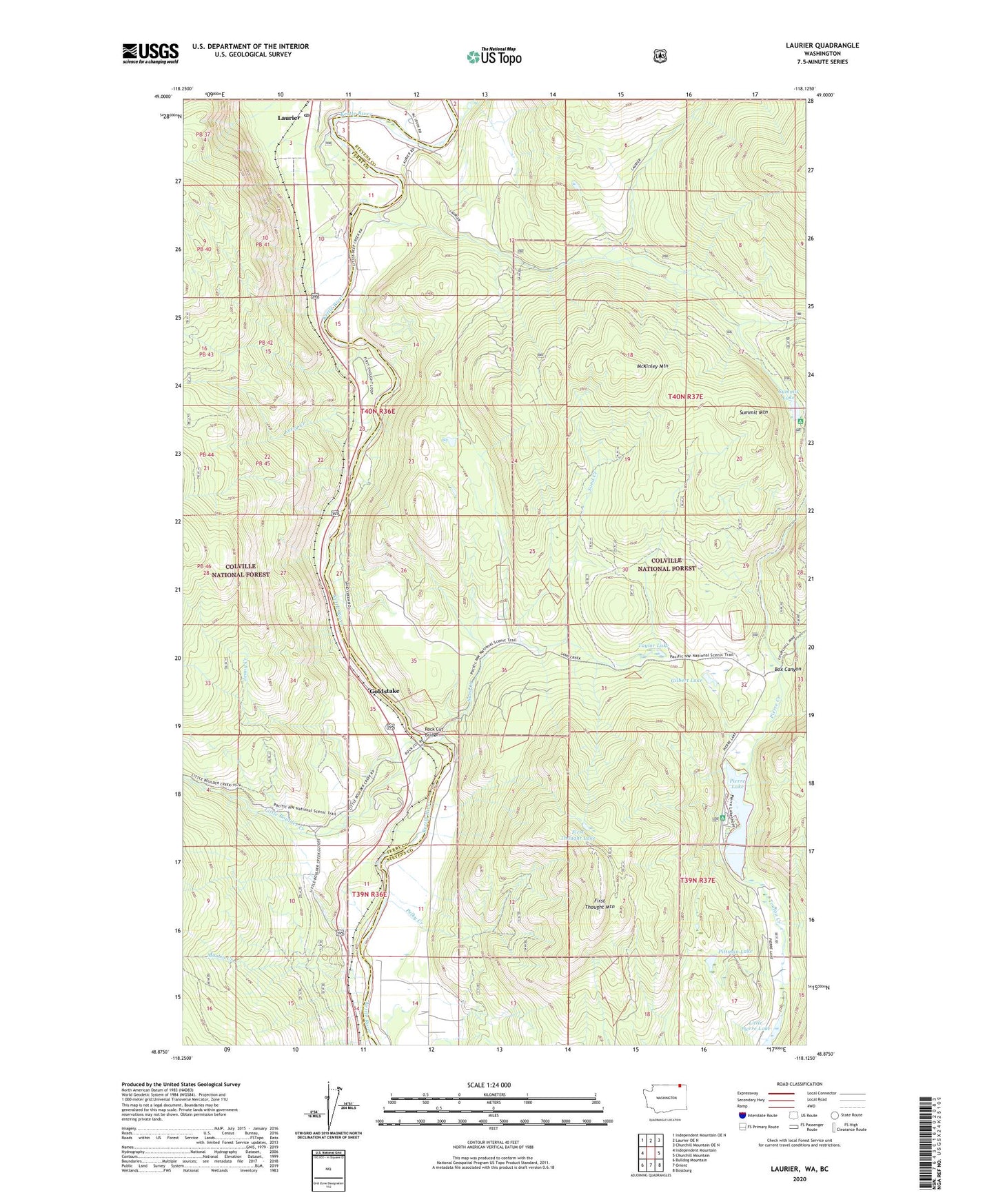
2023 topographic map quadrangle Laurier in the state of Washington. Scale: 1:24000. Based on the newly updated USGS 7.5' US Topo map series, this map is in the following counties: Stevens, Ferry. The map contains contour data, water features, and other items you are used to seeing on USGS maps, but also has updated roads and other features. This is the next generation of topographic maps. Printed on high-quality waterproof paper with UV fade-resistant inks.
Quads adjacent to this one:
West: Independent Mountain
Northwest: Independent Mountain OE N
North: Laurier OE N
Northeast: Churchill Mountain OE N
East: Churchill Mountain
Southeast: Bossburg
South: Orient
Southwest: Bulldog Mountain
This map covers the same area as the classic USGS quad with code o48118h2.
Contains the following named places: Avey Field, Box Canyon, Deep Creek, First Thought Lake, First Thought Mine, First Thought Mountain, Gilbert Lake, Goldstake, Hughes, Jenny Creek, Kerry Creek, Kettle River Mine, Laurier, Laurier Census Designated Place, Laurier Port of Entry, Laurier Post Office, Little Boulder Creek, Little Pierre Lake, Martin Creek, McKinley Mountain, North Fork Deep Creek, Orient Ranger Station, Orient Work Center, Pelky Creek, Pierre Creek, Pierre Lake, Pierre Lake Campground, Pittman Lake, Red Lion Mine, Rock Cut, Rock Cut Bridge, Sand Creek, Standing Circle R Ranch Airport, Summit Lake, Summit Mountain, Talisman Mine, Taylor Lake