MyTopo
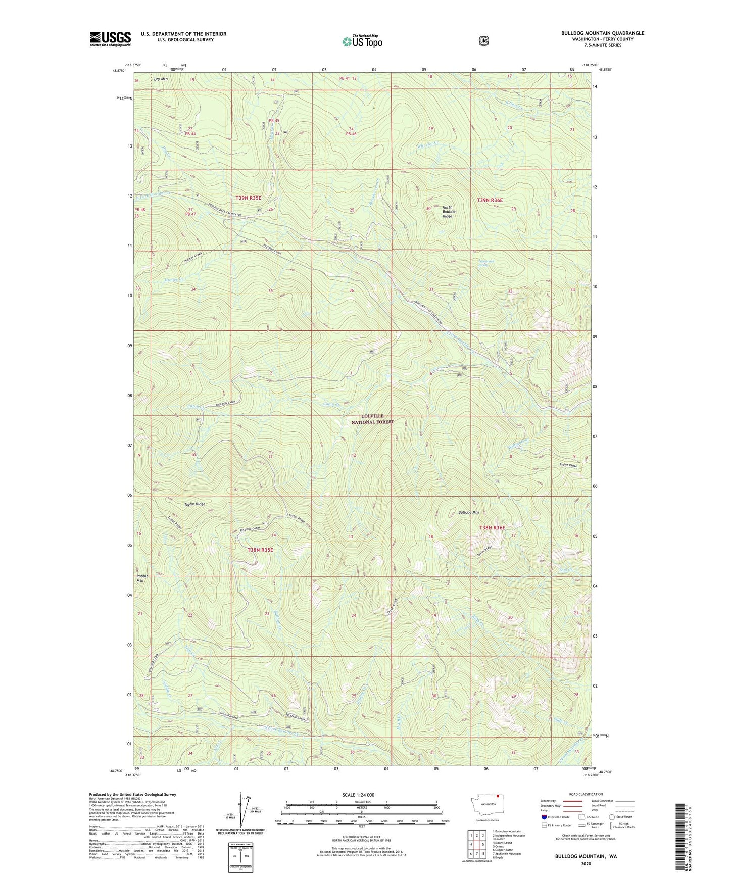
Bulldog Mountain Washington US Topo Map
Couldn't load pickup availability
Also explore the Bulldog Mountain Forest Service Topo of this same quad for updated USFS data
2023 topographic map quadrangle Bulldog Mountain in the state of Washington. Scale: 1:24000. Based on the newly updated USGS 7.5' US Topo map series, this map is in the following counties: Ferry. The map contains contour data, water features, and other items you are used to seeing on USGS maps, but also has updated roads and other features. This is the next generation of topographic maps. Printed on high-quality waterproof paper with UV fade-resistant inks.
Quads adjacent to this one:
West: Mount Leona
Northwest: Boundary Mountain
North: Independent Mountain
Northeast: Laurier
East: Orient
Southeast: Boyds
South: Jackknife Mountain
Southwest: Copper Butte
This map covers the same area as the classic USGS quad with code o48118g3.
Contains the following named places: Bulldog Creek, Bulldog Mountain, Butte Fork, Cabin Creek, Dry Creek, Dry Mountain, Friday Creek, Goat Creek, Hunter Creek, Indian Creek, Laddie Creek, North Boulder Ridge, Roesheisen Creek, Slide Creek, Tamarack spring, Trio Creek, U S Creek, Wheeler Creek, Williams Creek, ZIP Code: 99160