
MyTopo
Ione Washington US Topo Map
Couldn't load pickup availability
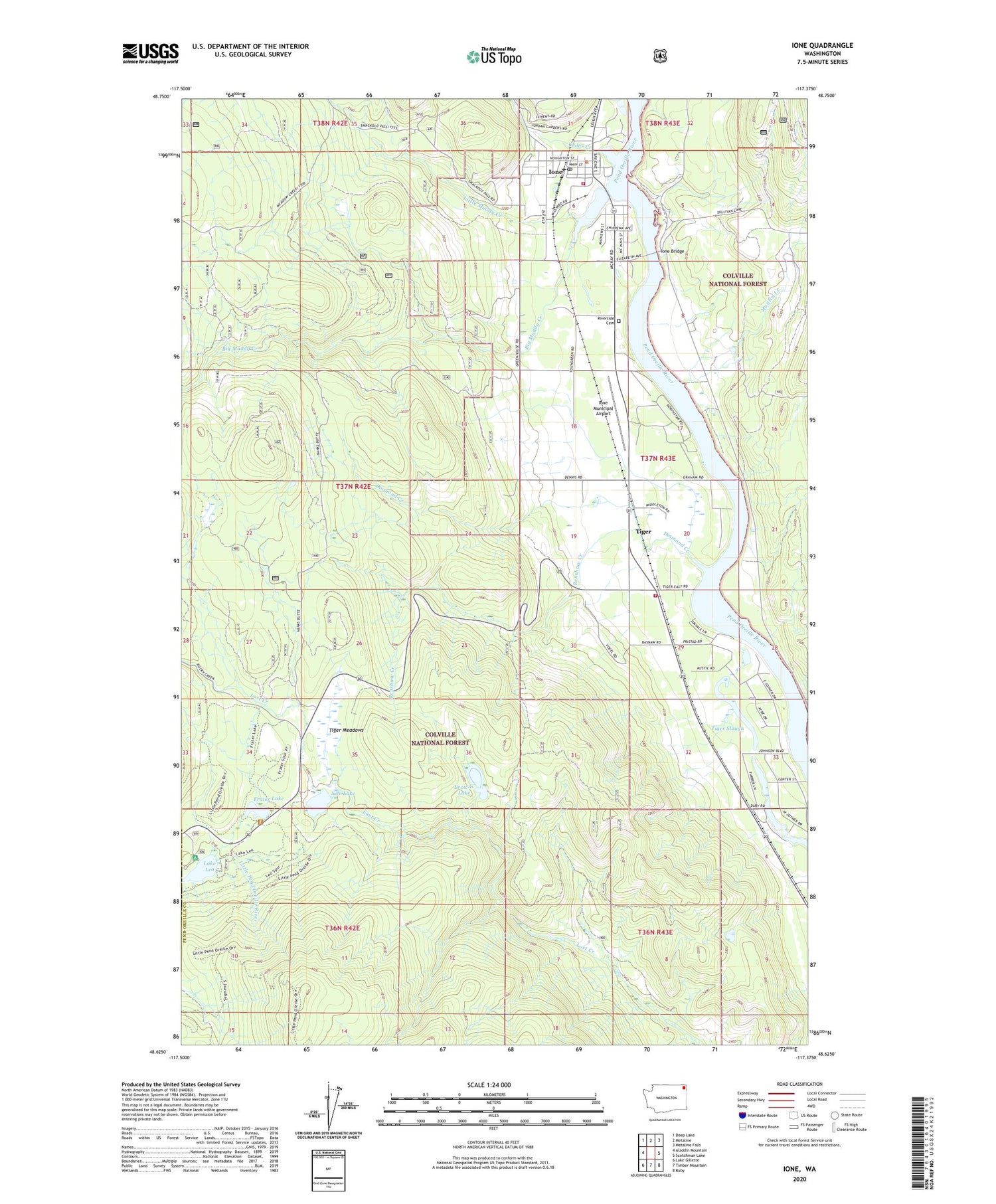
2020 topographic map quadrangle Ione in the state of Washington. Scale: 1:24000. Based on the newly updated USGS 7.5' US Topo map series, this map is in the following counties: Pend Oreille, Stevens. The map contains contour data, water features, and other items you are used to seeing on USGS maps, but also has updated roads and other features. This is the next generation of topographic maps. Printed on high-quality waterproof paper with UV fade-resistant inks.
Quads adjacent to this one:
West: Aladdin Mountain
Northwest: Deep Lake
North: Metaline
Northeast: Metaline Falls
East: Scotchman Lake
Southeast: Ruby
South: Timber Mountain
Southwest: Lake Gillette
Contains the following named places: Big Muddy Creek, Browns Lake, Cedar Creek, Diamond Creek, Frater Lake, Ione, Ione Baptist Church, Ione Bridge, Ione City Hall, Ione Community Center, Ione Mill Pond Dam, Ione Millpond, Ione Municipal Airport, Ione Pit, Ione Post Office, Ione Primary School, Ione Public Library, Ione Sewage Treatment Plant, Ione Volunteer Fire Department, Lake Leo, Lake Leo Campground, Little Muddy Creek, Maitlen Creek, Nile Lake, Pend Oreille Fire District 2 Station 23, Renshaw Creek, Riverside Cemetery, Serendipity Golf Course, Tiger, Tiger Meadows, Tiger Slough, Town of Ione


