MyTopo
Metaline Washington US Topo Map
Couldn't load pickup availability
Also explore the Metaline Forest Service Topo of this same quad for updated USFS data
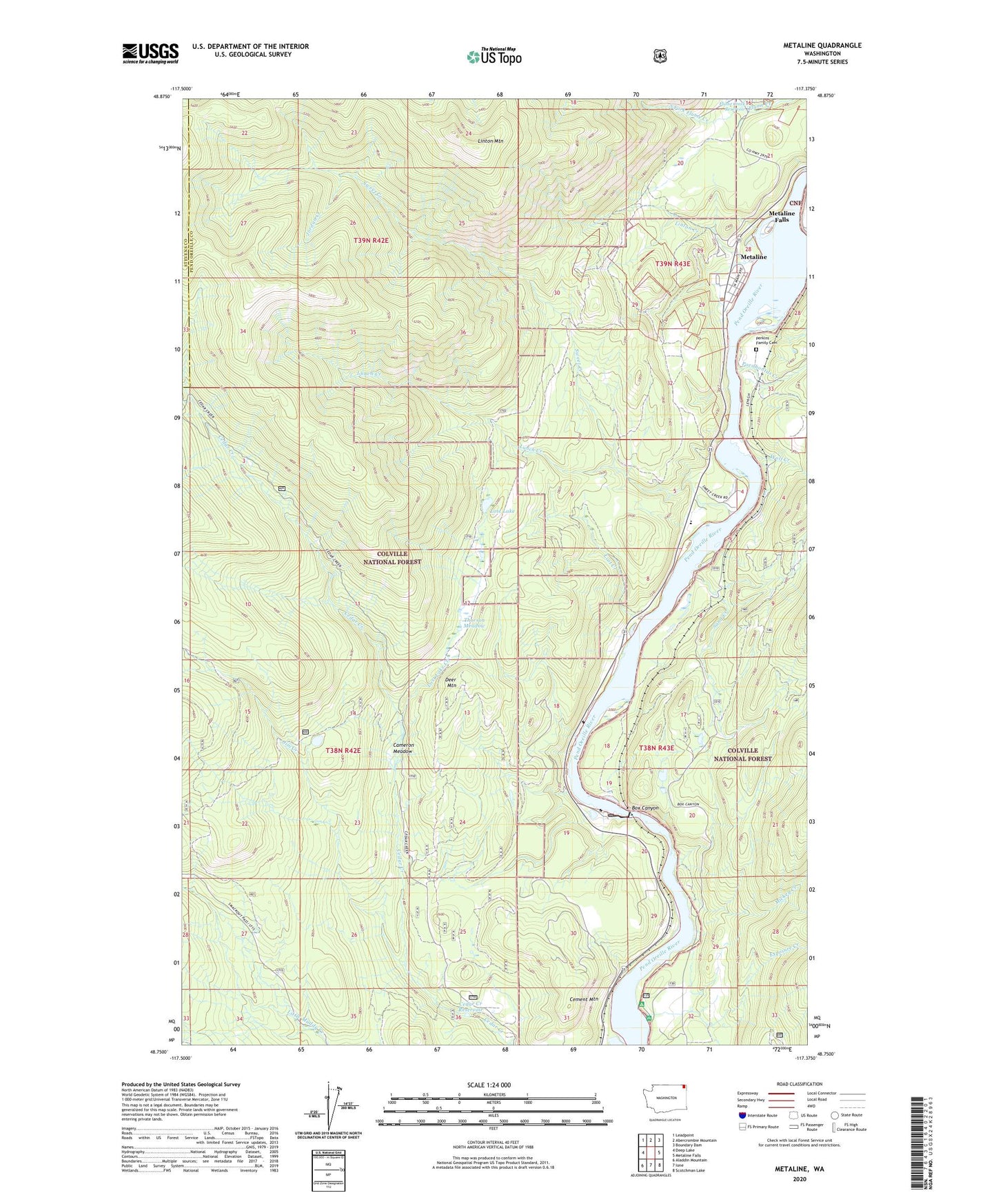
2023 topographic map quadrangle Metaline in the state of Washington. Scale: 1:24000. Based on the newly updated USGS 7.5' US Topo map series, this map is in the following counties: Pend Oreille, Stevens. The map contains contour data, water features, and other items you are used to seeing on USGS maps, but also has updated roads and other features. This is the next generation of topographic maps. Printed on high-quality waterproof paper with UV fade-resistant inks.
Quads adjacent to this one:
West: Deep Lake
Northwest: Leadpoint
North: Abercrombie Mountain
Northeast: Boundary Dam
East: Metaline Falls
Southeast: Scotchman Lake
South: Ione
Southwest: Aladdin Mountain
This map covers the same area as the classic USGS quad with code o48117g4.
Contains the following named places: Bella May Mine, Box Canyon, Box Canyon Dam, Box Canyon Dam Viewpoint, Box Canyon Reservoir, Cameron Meadow, Cedar Creek Reservoir, Cedar Creek Reservoir Dam, Cement Mountain, Deer Mountain, Edgewater Campground, Exposure Creek, Flume Creek Reservoir, Flume Creek Reservoir Dam, Jim Creek, Jordan Creek, Linton Creek, Linton Mountain, Lost Creek, Lost Lake, Lost Lake Creek, Lunch Creek, Metaline, Metaline City Hall, Metaline Sewage Treatment Plant, Mickey Creek, Oriole Mine, Pend Oreille County Pud Dam, Perkins Family Cemetery, Pocahontas Creek, Sand Creek, Selkirk Junior Senior High School, South Fork Flume Creek, South Fork Jim Creek, Sweet Creek, Thorson Meadow, Town of Metaline, Wolf Creek, ZIP Codes: 99139, 99152