MyTopo
Scotchman Lake Washington US Topo Map
Couldn't load pickup availability
Also explore the Scotchman Lake Forest Service Topo of this same quad for updated USFS data
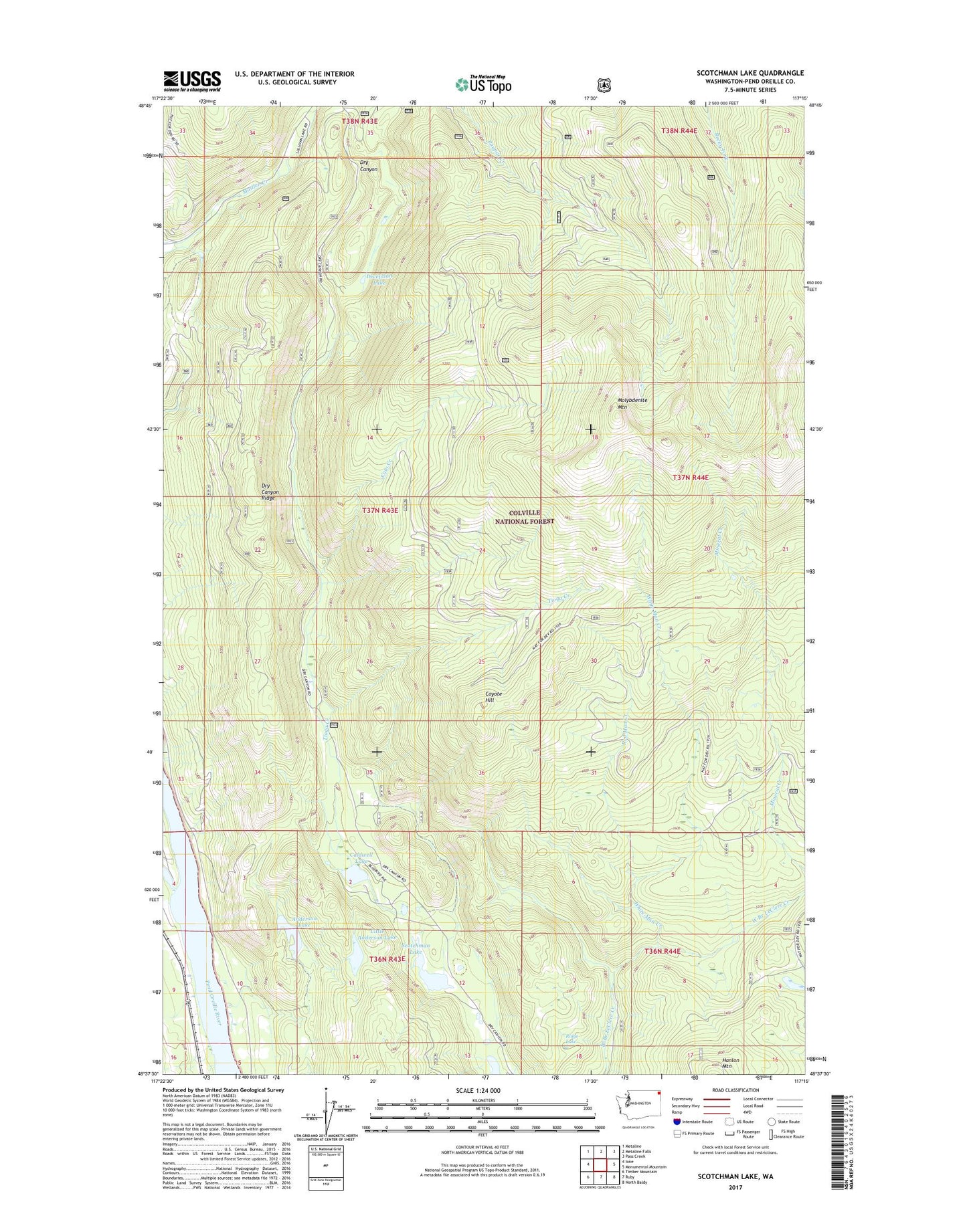
2023 topographic map quadrangle Scotchman Lake in the state of Washington. Scale: 1:24000. Based on the newly updated USGS 7.5' US Topo map series, this map is in the following counties: Pend Oreille. The map contains contour data, water features, and other items you are used to seeing on USGS maps, but also has updated roads and other features. This is the next generation of topographic maps. Printed on high-quality waterproof paper with UV fade-resistant inks.
Quads adjacent to this one:
West: Ione
Northwest: Metaline
North: Metaline Falls
Northeast: Pass Creek
East: Monumental Mountain
Southeast: North Baldy
South: Ruby
Southwest: Timber Mountain
This map covers the same area as the classic USGS quad with code o48117f3.
Contains the following named places: Anderson Lake, Caldwell Lake, Cato Creek, Coyote Hill, Deception Lake, Dry Canyon Lookout, Dry Canyon Ridge, Little Anderson Lake, Molybdenite Mountain, Red Man Creek, Ridge Lake, Scotchman Lake, Tioga Creek, White Man Creek