MyTopo
Joe Lake Washington US Topo Map
Couldn't load pickup availability
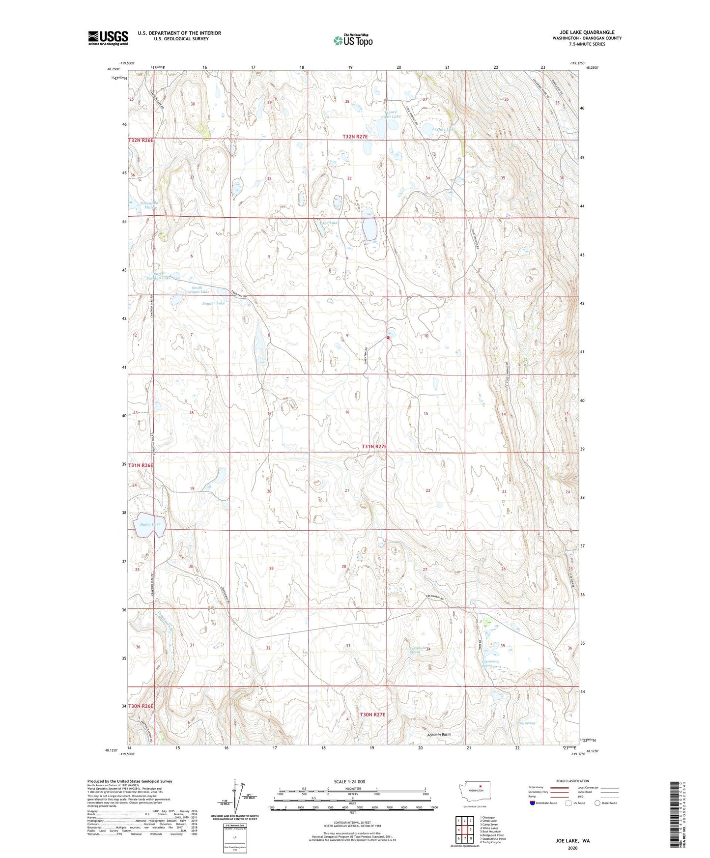
2020 topographic map quadrangle Joe Lake in the state of Washington. Scale: 1:24000. Based on the newly updated USGS 7.5' US Topo map series, this map is in the following counties: Okanogan. The map contains contour data, water features, and other items you are used to seeing on USGS maps, but also has updated roads and other features. This is the next generation of topographic maps. Printed on high-quality waterproof paper with UV fade-resistant inks.
Quads adjacent to this one:
West: White Lakes
Northwest: Okanogan
North: Omak Lake
Northeast: Camp Seven
East: Boot Mountain
Southeast: Trefry Canyon
South: Stubblefield Point
Southwest: Bridgeport Point
Contains the following named places: Allen Spring, Cunningham School, Cunningham Spring, Duley Lake, Figure Eight Lake, Freidlander Lake, Greenaway Spring, Joe Lake, LaFleur, North Furman Lake, Okanogan County Fire District 8, Snyder Lake, South Furman Lake, Timentwa Flats, White Lake