MyTopo
Lake Roesiger Washington US Topo Map
Couldn't load pickup availability
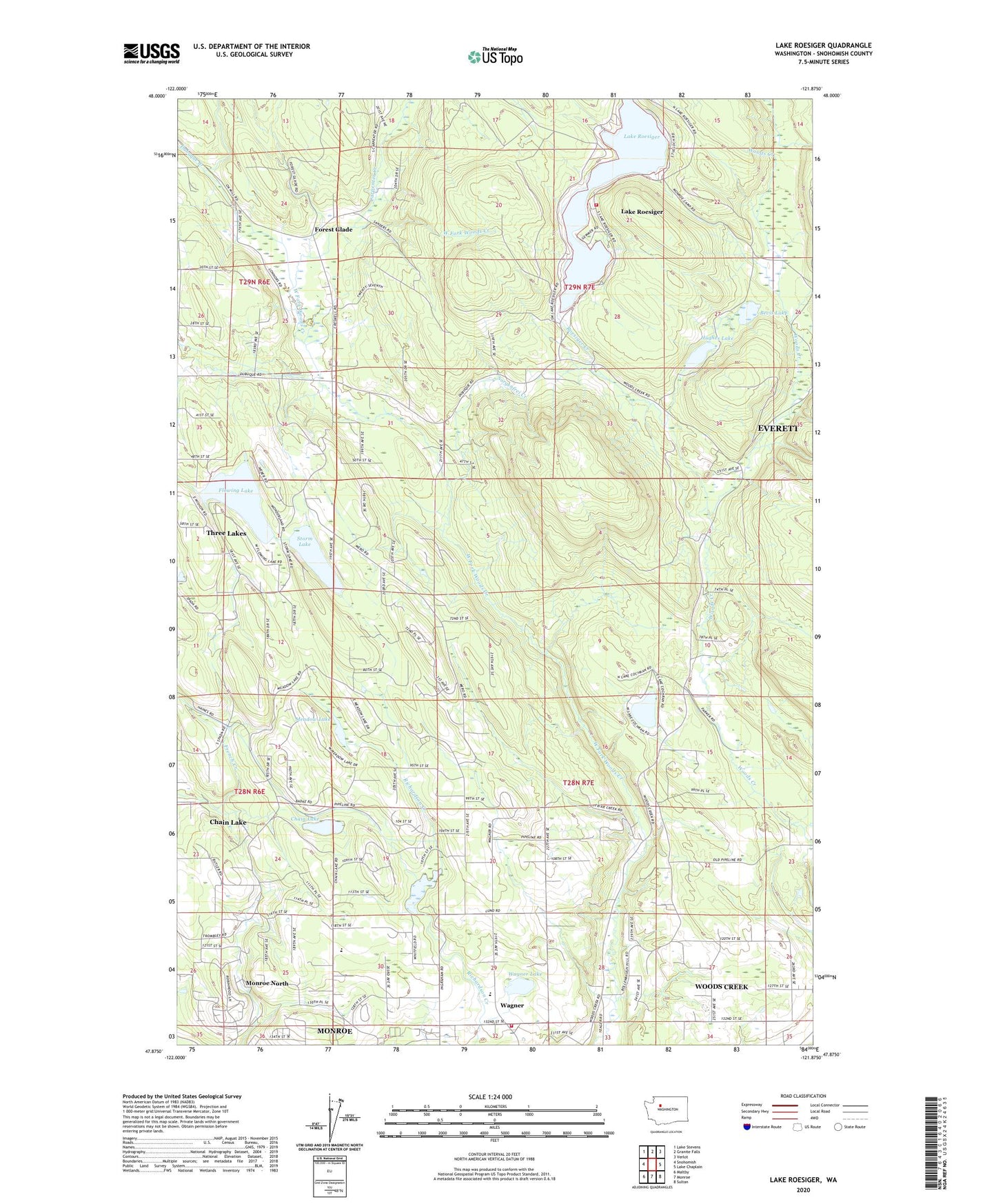
2020 topographic map quadrangle Lake Roesiger in the state of Washington. Scale: 1:24000. Based on the newly updated USGS 7.5' US Topo map series, this map is in the following counties: Snohomish. The map contains contour data, water features, and other items you are used to seeing on USGS maps, but also has updated roads and other features. This is the next generation of topographic maps. Printed on high-quality waterproof paper with UV fade-resistant inks.
Quads adjacent to this one:
West: Snohomish
Northwest: Lake Stevens
North: Granite Falls
Northeast: Verlot
East: Lake Chaplain
Southeast: Sultan
South: Monroe
Southwest: Maltby
Contains the following named places: Bevis Lake, Box R Farms, Bughollow Farm, Carpenter Creek, Chain Lake, Chain Lake Census Designated Place, Chain Lake Elementary School, Chief Seattle Boy Scout Reservation, Flowing Lake, Flowing Lake Park, Forest Glade, Hughes Lake, Lake Cochran, Lake Roesiger, Lake Roesiger Census Designated Place, Lake Roesiger Park, Meadow Lake, Monroe Division, Monroe Fire District 3 Station 32, Monroe North Census Designated Place, Roesiger Creek, Salem Woods Elementary School, Snohomish County Fire District 16 Station 85 - Lake Roesiger, Sorgenfrei Creek, Storm Lake, Swinging R Ranch, Three Lakes, Three Lakes Census Designated Place, Wagner, Wagner Lake, Woods Creek, Woods Creek Census Designated Place, ZIP Code: 98290