MyTopo
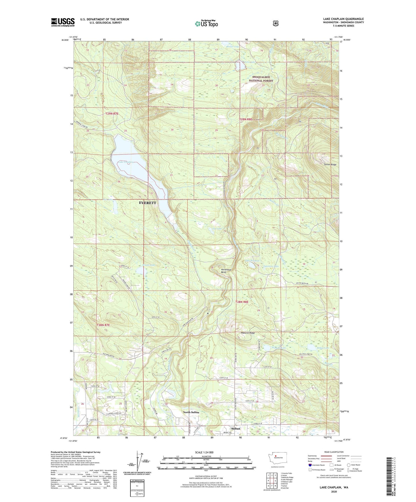
Lake Chaplain Washington US Topo Map
Couldn't load pickup availability
Also explore the Lake Chaplain Forest Service Topo of this same quad for updated USFS data
2023 topographic map quadrangle Lake Chaplain in the state of Washington. Scale: 1:24000. Based on the newly updated USGS 7.5' US Topo map series, this map is in the following counties: Snohomish. The map contains contour data, water features, and other items you are used to seeing on USGS maps, but also has updated roads and other features. This is the next generation of topographic maps. Printed on high-quality waterproof paper with UV fade-resistant inks.
Quads adjacent to this one:
West: Lake Roesiger
Northwest: Granite Falls
North: Verlot
Northeast: Mallardy Ridge
East: Wallace Lake
Southeast: Gold Bar
South: Sultan
Southwest: Monroe
This map covers the same area as the classic USGS quad with code o47121h7.
Contains the following named places: Beaver Lake, Big Four Creek, Blue Boy West Golf Course, Blue Mountain Lookout, Chaplain Creek, Chaplain Lake North Dam, Chaplain Lake South Dam, Echo Lake, Everett Water Work Intake, Freeman Dam, Haywire Ridge, Horseshoe Bend, Ida Lake, Japanese Lake, Kellog Lake, Lake Bronson, Lake Chaplain, Lost Lake, Marsh Creek, Miners Creek, North Sultan, North Sultan Census Designated Place, Rain Spirit Farm, Ritz Creek, Winters Lake, Woods Lake