MyTopo
Granite Falls Washington US Topo Map
Couldn't load pickup availability
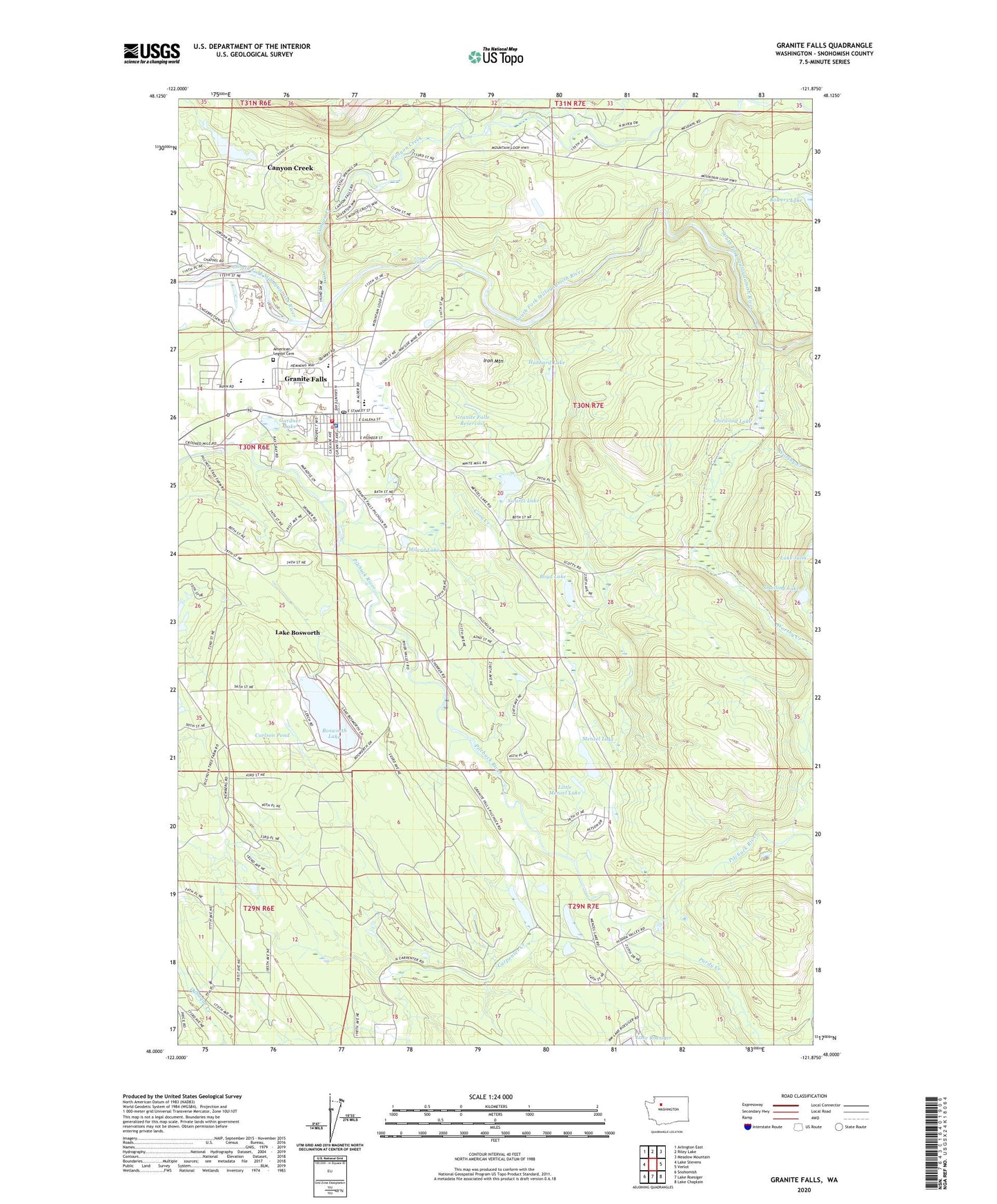
2023 topographic map quadrangle Granite Falls in the state of Washington. Scale: 1:24000. Based on the newly updated USGS 7.5' US Topo map series, this map is in the following counties: Snohomish. The map contains contour data, water features, and other items you are used to seeing on USGS maps, but also has updated roads and other features. This is the next generation of topographic maps. Printed on high-quality waterproof paper with UV fade-resistant inks.
Quads adjacent to this one:
West: Lake Stevens
Northwest: Arlington East
North: Riley Lake
Northeast: Meadow Mountain
East: Verlot
Southeast: Lake Chaplain
South: Lake Roesiger
Southwest: Snohomish
This map covers the same area as the classic USGS quad with code o48121a8.
Contains the following named places: American Legion Cemetery, Bosworth Lake, Bowers Lake, Boyd Lake, Canyon Creek, Canyon Creek Census Designated Place, Canyon Creek Lodge, Carlson Pond, Chitwood Lake, City of Granite Falls, Community Bible Church, Coon Creek, Creative Kids Preschool and Daycare Center, Far Point Sand Quarry, Father's House Foursquare Church, Gardner Dam, Gardner Lake, Granite Falls, Granite Falls Bible Baptist Church, Granite Falls Child Care Center, Granite Falls Christian Alliance, Granite Falls City Hall, Granite Falls Elementary School, Granite Falls High School, Granite Falls Library, Granite Falls Middle School, Granite Falls Police Department, Granite Falls Post Office, Granite Falls Quarry, Granite Falls Reservoir, Granite Falls Senior Center, Granite Falls Sewage Treatment Plant, Grantie Falls Substation, Hidden Valley Camp, Hubbard Lake, Iron Mountain, Iron Mountain Quarry, Lake Bosworth, Lake Bosworth Census Designated Place, Little Menzel Lake, Lutheran Chapel on the Hill, Mandan Sand and Gravel Quarry, Menzel Lake, Menzel Lake Gravel Quarry, Milard Lake, Monte Cristo Elementary School, Mountain Way Elementary School, Perrigone Memorial Park, Pilchuck, Pilchuck Mobile Park, Pilchuck Quarry, Pilchuck River Dam, Prove - Crossroads Alternative High School, Purdy Creek, Sandhill Quarry, Smelling Lake, Snohomish County Fire District 17 Station 87, Snohomish County Solid Waste, Swartz Lake, Sweet Dam, Wayside Mine