MyTopo
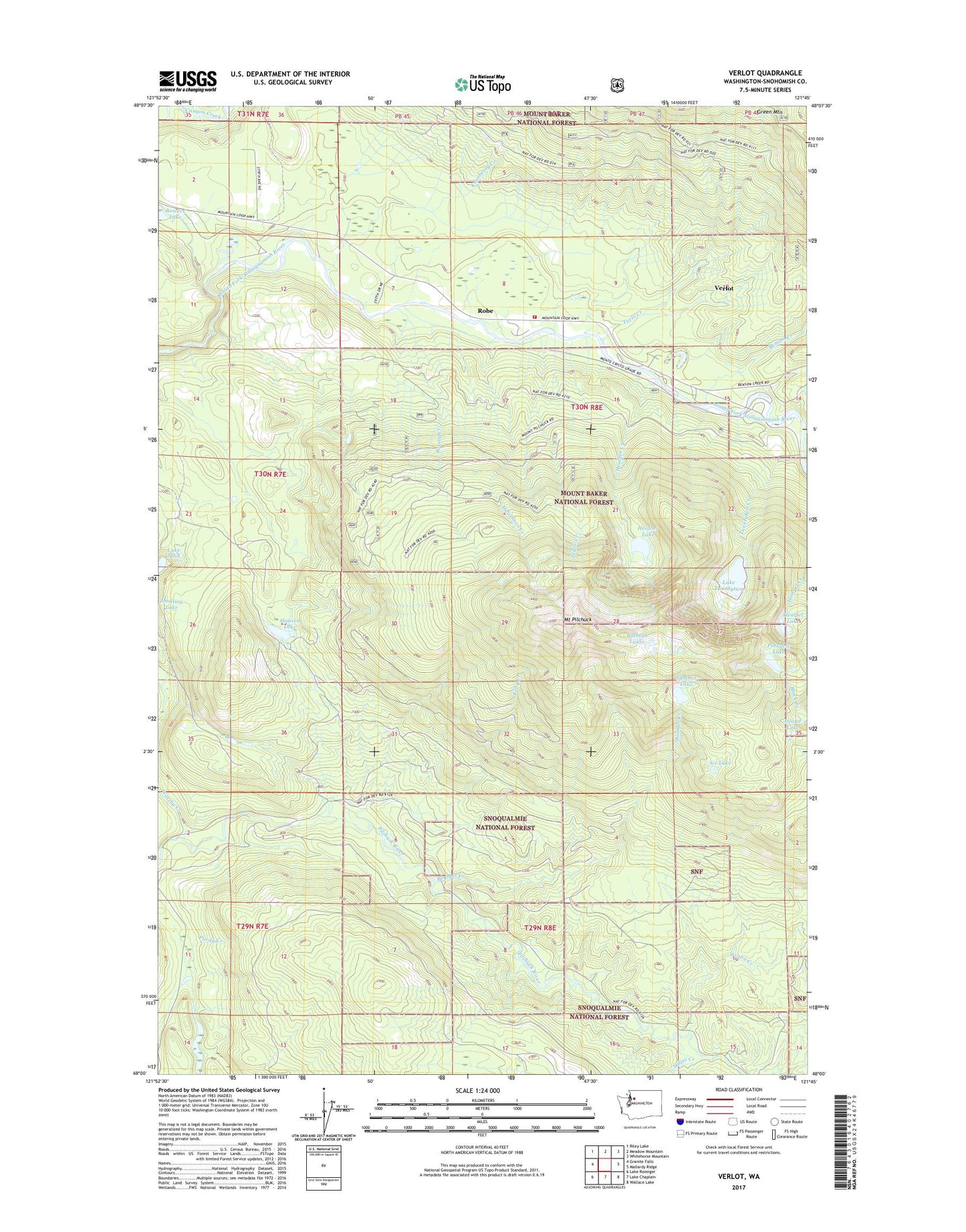
Verlot Washington US Topo Map
Couldn't load pickup availability
Also explore the Verlot Forest Service Topo of this same quad for updated USFS data
2023 topographic map quadrangle Verlot in the state of Washington. Scale: 1:24000. Based on the newly updated USGS 7.5' US Topo map series, this map is in the following counties: Snohomish. The map contains contour data, water features, and other items you are used to seeing on USGS maps, but also has updated roads and other features. This is the next generation of topographic maps. Printed on high-quality waterproof paper with UV fade-resistant inks.
Quads adjacent to this one:
West: Granite Falls
Northwest: Riley Lake
North: Meadow Mountain
Northeast: Whitehorse Mountain
East: Mallardy Ridge
Southeast: Wallace Lake
South: Lake Chaplain
Southwest: Lake Roesiger
This map covers the same area as the classic USGS quad with code o48121a7.
Contains the following named places: Bathtub Lakes, Benson Creek, Boulder Creek, Cranberry Creek, Echo Lake Truck Trail, Granite Falls Division, Hanson Lake, Hawthorn Creek, Heather Creek, Heather Lake, Hempel Lake, Island Lake, Kelly Creek, Lake Julia, Lake Twentytwo, Lake Twentytwo Research Natural Area, Miller Creek, Mount Pilchuck, Mount Pilchuck State Forest, Mount Pilchuck Trailhead, Pinnacle Lake, Robe, Ross Creek, Rotary Creek, Six Lake, Snohomish County Fire District 23, Summit Lake, Triple Creek, Turlo Campground, Turlo Creek, Twentytwo Creek, Verlot, Verlot Campground, Verlot Census Designated Place, Verlot Public Service Center, Wilson Creek, Worthy Creek