MyTopo
Levey Washington US Topo Map
Couldn't load pickup availability
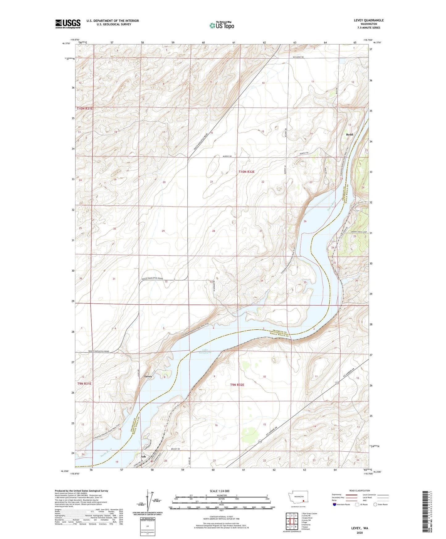
2023 topographic map quadrangle Levey in the state of Washington. Scale: 1:24000. Based on the newly updated USGS 7.5' US Topo map series, this map is in the following counties: Franklin, Walla Walla. The map contains contour data, water features, and other items you are used to seeing on USGS maps, but also has updated roads and other features. This is the next generation of topographic maps. Printed on high-quality waterproof paper with UV fade-resistant inks.
Quads adjacent to this one:
West: Levey SW
Northwest: Rye Grass Coulee
North: Levey NE
Northeast: Snake River
East: Page
Southeast: Welland
South: Slater
Southwest: Humorist
This map covers the same area as the classic USGS quad with code o46118c7.
Contains the following named places: Ash, Big Flat Habitat Management Unit, Charbonneau Park, Charbonneau Recreation Area, Dalton Lake, Emma Lake, Fishhook Park, Juniper Forest Survival Training Site, Levey, Levey Landing Park, Redd, Walla Walla County Fire District 5 Station 53