MyTopo
Humorist Washington US Topo Map
Couldn't load pickup availability
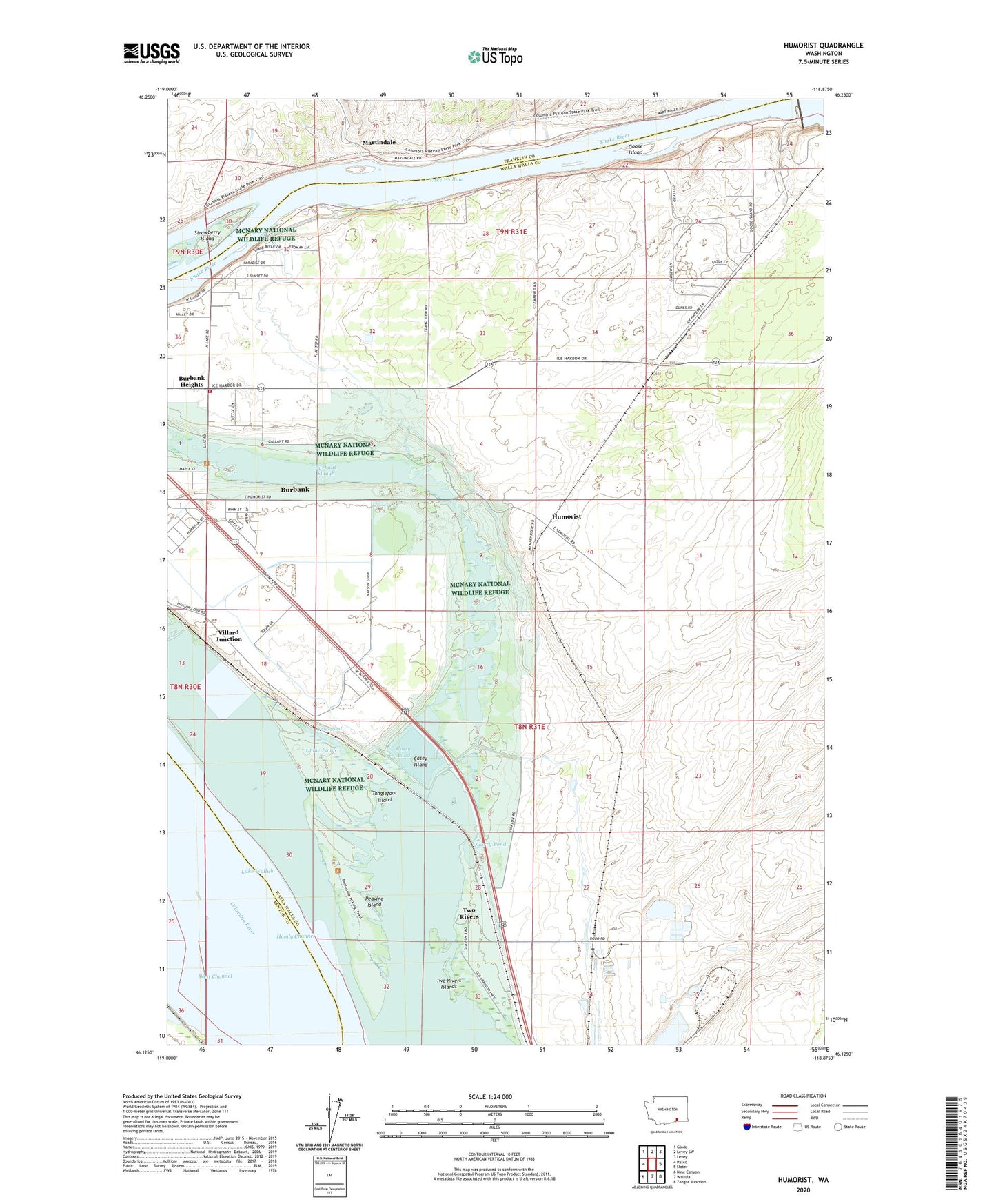
2023 topographic map quadrangle Humorist in the state of Washington. Scale: 1:24000. Based on the newly updated USGS 7.5' US Topo map series, this map is in the following counties: Walla Walla, Franklin, Benton. The map contains contour data, water features, and other items you are used to seeing on USGS maps, but also has updated roads and other features. This is the next generation of topographic maps. Printed on high-quality waterproof paper with UV fade-resistant inks.
Quads adjacent to this one:
West: Pasco
Northwest: Glade
North: Levey SW
Northeast: Levey
East: Slater
Southeast: Zangar Junction
South: Wallula
Southwest: Nine Canyon
This map covers the same area as the classic USGS quad with code o46118b8.
Contains the following named places: Burbank Census Designated Place, Burbank Division, Burbank Slough, Burbank Substation, Casey Island, Casey Pond, Columbia High School, Curlew Pond, Foundation Island, Goose Island, High Lift Canal, Homly Channel, Humorist, Ice Harbor Lock and Dam, Iowa Beef Processors Waste Pond, J Line Pond, Locust Grove, Martindale, Peavine Island, Quarry Pond, Strawberry Island, Tanglefoot Island, Two Rivers, Two Rivers Islands, Two Rivers Post Office, Villard Junction, Walla Walla County Fire District 5 Station 54, West Channel