
MyTopo
Lincoln Washington US Topo Map
Couldn't load pickup availability
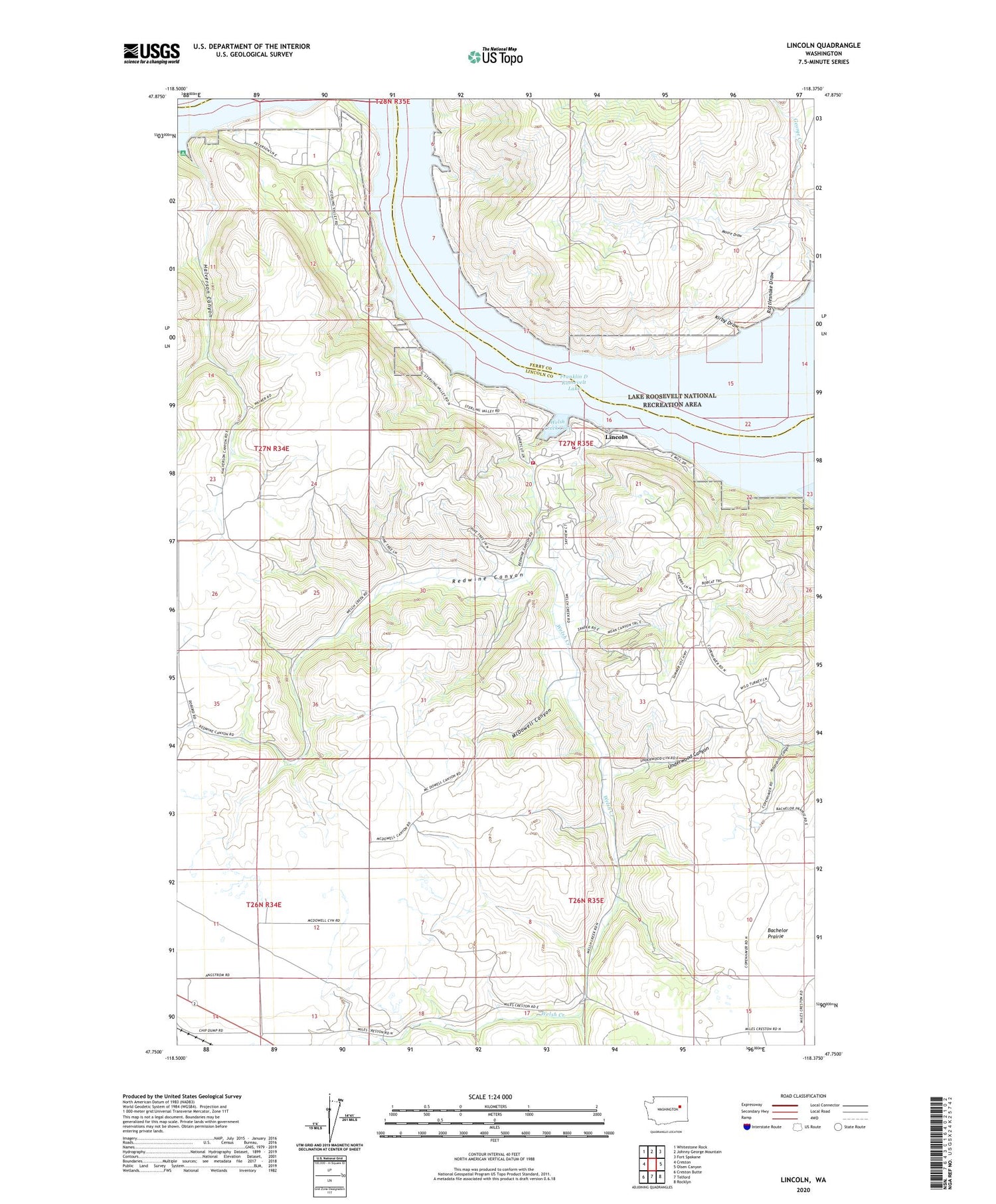
2020 topographic map quadrangle Lincoln in the state of Washington. Scale: 1:24000. Based on the newly updated USGS 7.5' US Topo map series, this map is in the following counties: Lincoln, Ferry. The map contains contour data, water features, and other items you are used to seeing on USGS maps, but also has updated roads and other features. This is the next generation of topographic maps. Printed on high-quality waterproof paper with UV fade-resistant inks.
Quads adjacent to this one:
West: Creston
Northwest: Whitestone Rock
North: Johnny George Mountain
Northeast: Fort Spokane
East: Olsen Canyon
Southeast: Rocklyn
South: Telford
Southwest: Creston Butte
Contains the following named places: Elbow Bend, Halverson Canyon, Kirby Draw, Lincoln, Lincoln County Fire District 7, Lincoln Fire Station, McDowell Canyon, Rattlesnake Draw, Redwine Canyon, Sterling Valley, Underwood Canyon, Welsh Creek, Welsh Creek Cove


