MyTopo
Malaga Washington US Topo Map
Couldn't load pickup availability
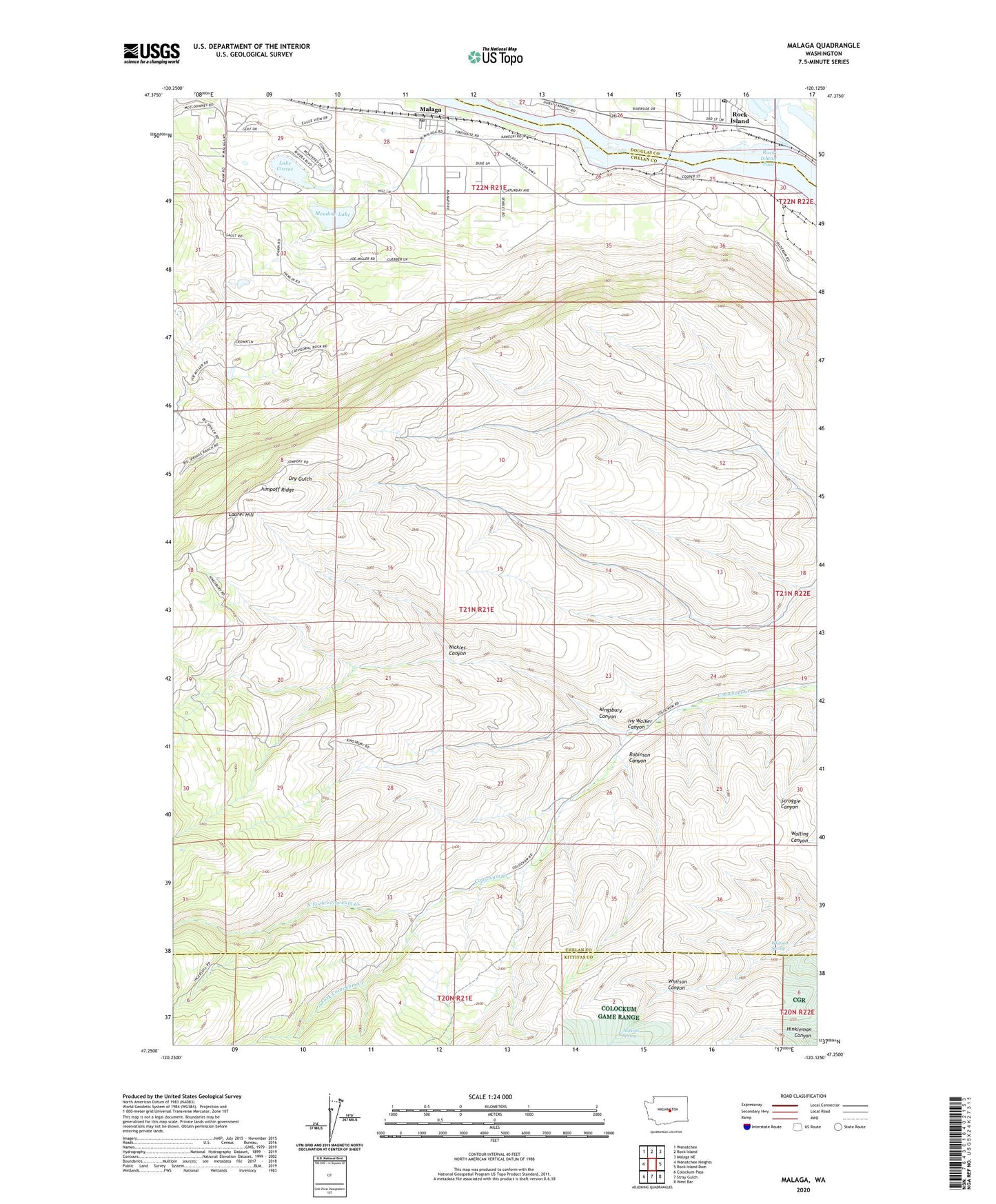
2023 topographic map quadrangle Malaga in the state of Washington. Scale: 1:24000. Based on the newly updated USGS 7.5' US Topo map series, this map is in the following counties: Chelan, Kittitas, Douglas. The map contains contour data, water features, and other items you are used to seeing on USGS maps, but also has updated roads and other features. This is the next generation of topographic maps. Printed on high-quality waterproof paper with UV fade-resistant inks.
Quads adjacent to this one:
West: Wenatchee Heights
Northwest: Wenatchee
North: Rock Island
Northeast: Malaga NE
East: Rock Island Dam
Southeast: West Bar
South: Stray Gulch
Southwest: Colockum Pass
This map covers the same area as the classic USGS quad with code o47120c2.
Contains the following named places: Chelan County Fire District 1 Station 17 Malaga Complex, City of Rock Island, Colockum Research Unit Washington State University, Ivy Walker Canyon, Judkins Spring, Jumpoff Ridge, KCWT-TV (Wenatchee), Keokuk, Keokuk Substation, Kingsbury Canyon, Lake Cortez, Laurel Hill, Malaga, Malaga Post Office, McLaughlin Dam, Meadow Lake, Meadow Lake Dam, Nickles Canyon, North Fork Colockum Creek, Robinson Canyon, Rock Island Post Office, South Fork Colockum Creek, Three Lakes Golf Club, Three Lakes Reservoir Dam, Valhala Substation, Whitson Spring, ZIP Code: 98828