MyTopo
Rock Island Dam Washington US Topo Map
Couldn't load pickup availability
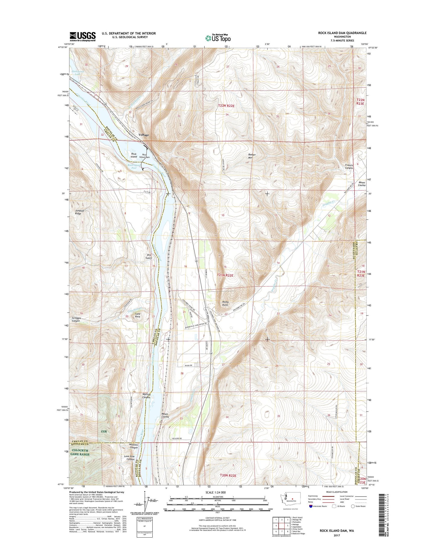
2023 topographic map quadrangle Rock Island Dam in the state of Washington. Scale: 1:24000. Based on the newly updated USGS 7.5' US Topo map series, this map is in the following counties: Douglas, Chelan, Kittitas, Grant. The map contains contour data, water features, and other items you are used to seeing on USGS maps, but also has updated roads and other features. This is the next generation of topographic maps. Printed on high-quality waterproof paper with UV fade-resistant inks.
Quads adjacent to this one:
West: Malaga
Northwest: Rock Island
North: Malaga NE
Northeast: Palisades
East: Appledale
Southeast: Babcock Ridge
South: West Bar
Southwest: Stray Gulch
This map covers the same area as the classic USGS quad with code o47120c1.
Contains the following named places: Bonspur, Cabinet Rapids, Colockum Creek, Colockum Game Range, Colockum Game Range Headquarters, Columbia River, Columbia Substation, Douglas Creek, Dry Gulch, Francis Canyon, Hammond Lake, Lone Pine Canyon, Lone Rock, Moses Coulee, Nixon Rapids, Rock Island, Rock Island Creek, Rock Island Dam, Rock Island State Park, Rocky Point, Scroggie Canyon, Voltage, Walling Canyon, Whitson Canyon, ZIP Code: 98850