
MyTopo
Marcus Washington US Topo Map
Couldn't load pickup availability
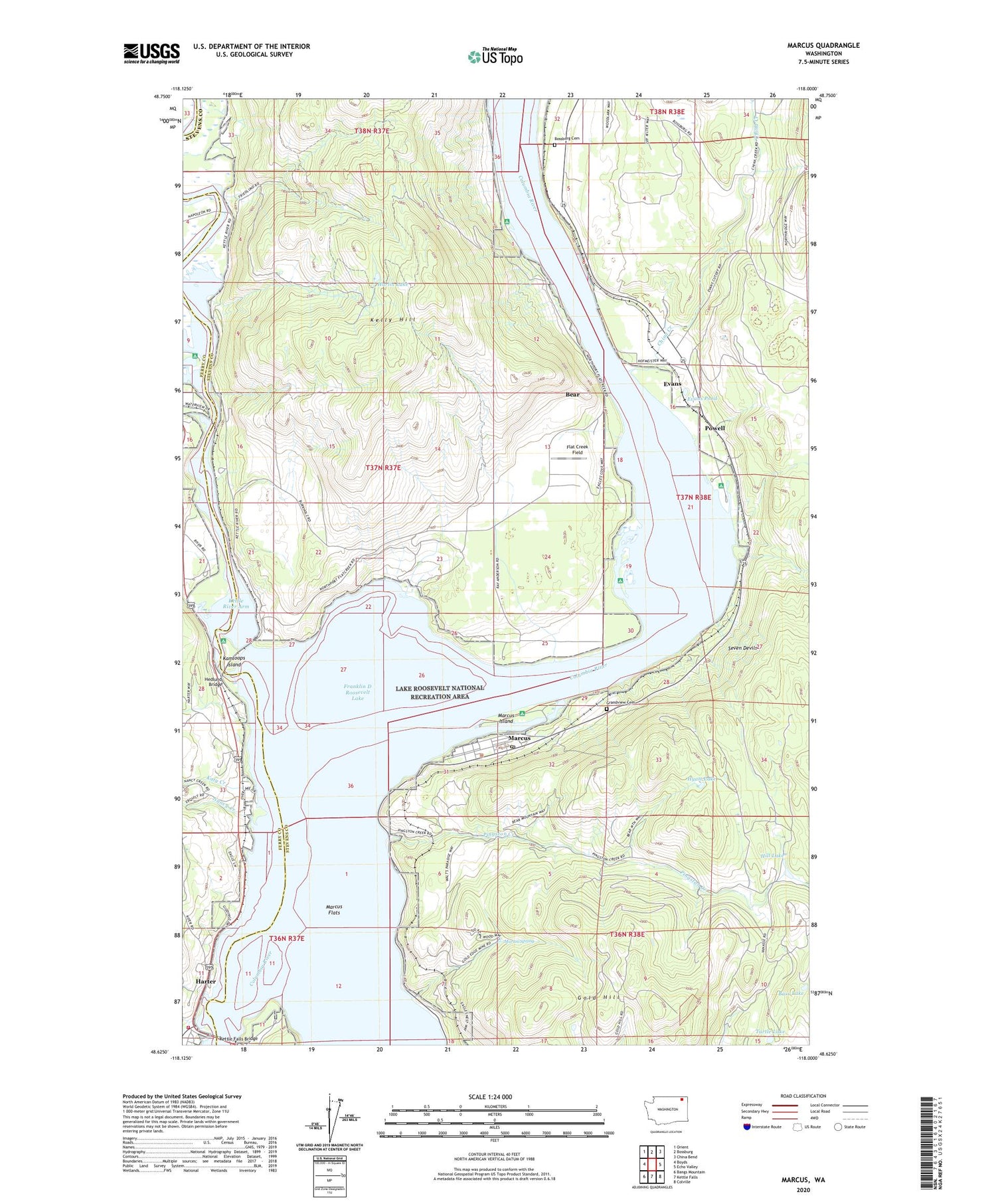
2020 topographic map quadrangle Marcus in the state of Washington. Scale: 1:24000. Based on the newly updated USGS 7.5' US Topo map series, this map is in the following counties: Stevens, Ferry. The map contains contour data, water features, and other items you are used to seeing on USGS maps, but also has updated roads and other features. This is the next generation of topographic maps. Printed on high-quality waterproof paper with UV fade-resistant inks.
Quads adjacent to this one:
West: Boyds
Northwest: Orient
North: Bossburg
Northeast: China Bend
East: Echo Valley
Southeast: Colville
South: Kettle Falls
Southwest: Bangs Mountain
Contains the following named places: Bass Lake, Bear, Blue Town, Bossburg Cemetery, China Creek, Columbia Quarry, Deadman Creek, Dipper Mine, East Marcus, Evans, Evans Campground, Evans Pond, Flat Creek Field, Godfrey, Gold Hill, Gold Ledge Mine, Gold Reef Mine, Grandview Cemetery, Harlin Lake, Harter, Hedlund Bridge, Hill Lake, Hyatt Lake, Joint Protection Ferry County Fire District 3 - Stevens County Fire District 8 Barneys, Kamloops Island, Kamloops Island Campground, Katy Creek, Kelly Hill, Kettle Falls, Kettle Falls Bridge, Kettle River, Kettle River Arm, Kettle River Campground, Kifer Quarry, Lakeside Mobile Home Park, Marcus, Marcus Flats, Marcus Island, Marcus Island Campground, Marcus Post Office, Martin Spring, Matneys Spurs, Nancy Creek, Napoleon, Napoleon Mine, Pingston Creek, Pot Holes, Powell, Presbyterian Church of Marcus, Saint Pauls Mission, Saint Pauls Mission State Historical Site, Seven Devils, Six Mile Bar, Snag Cove Campground, SPCC Spur, Stevens, Town of Marcus, Turtle Lake, Vanasse Mine, ZIP Code: 99151


