MyTopo
Mission Peak Washington US Topo Map
Couldn't load pickup availability
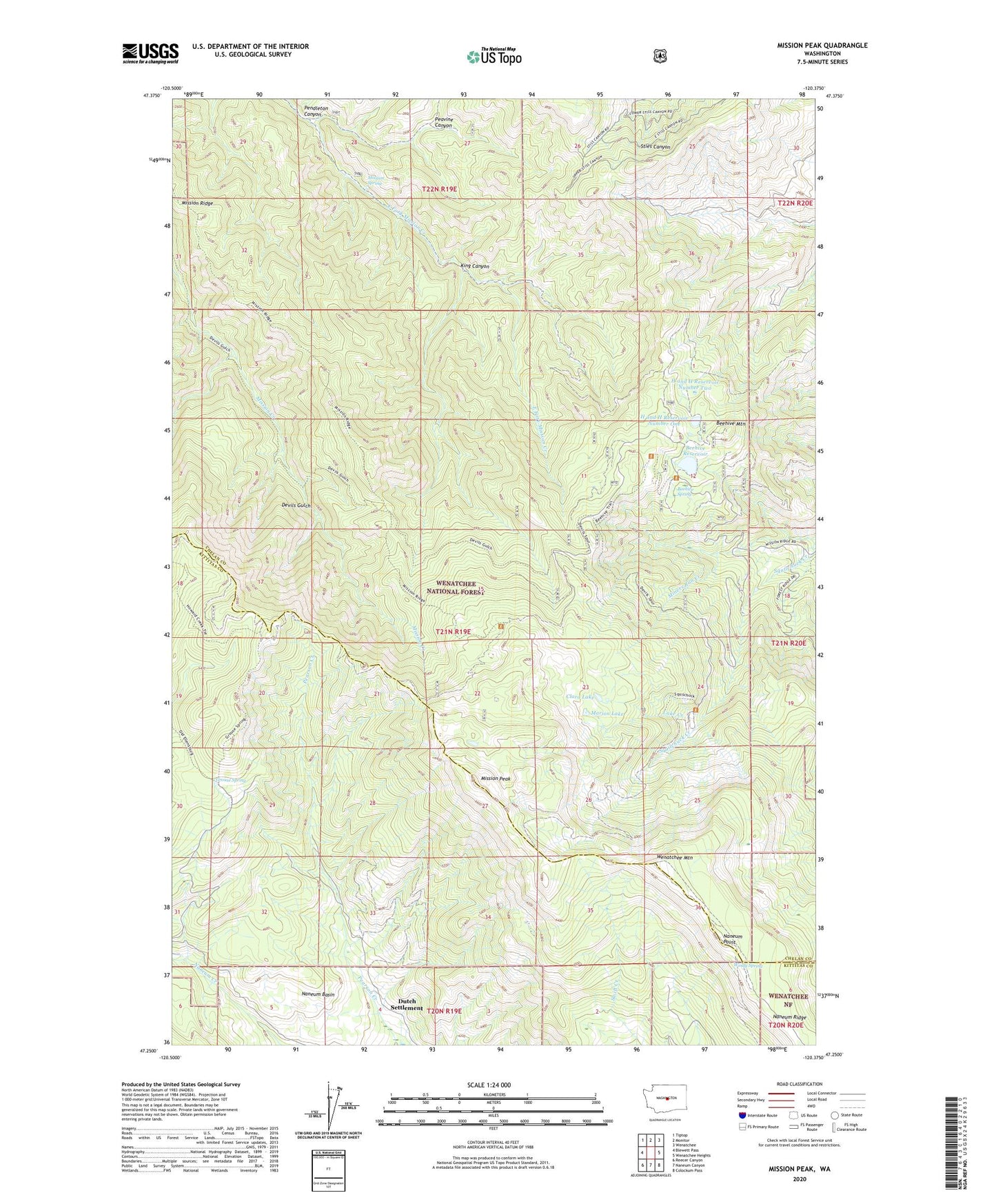
2020 topographic map quadrangle Mission Peak in the state of Washington. Scale: 1:24000. Based on the newly updated USGS 7.5' US Topo map series, this map is in the following counties: Chelan, Kittitas. The map contains contour data, water features, and other items you are used to seeing on USGS maps, but also has updated roads and other features. This is the next generation of topographic maps. Printed on high-quality waterproof paper with UV fade-resistant inks.
Quads adjacent to this one:
West: Blewett Pass
Northwest: Tiptop
North: Monitor
Northeast: Wenatchee
East: Wenatchee Heights
Southeast: Colockum Pass
South: Naneum Canyon
Southwest: Reecer Canyon
Contains the following named places: Alphine Campground, Beehive Dam, Beehive Mountain, Beehive Reservoir, Beehive Spring, Beehive Spring Campground, Clara Lake, Devils Gulch Trail, Dutch Settlement, Grouse Spring, H and H Reservoir Number One, H and H Reservoir Number One Dam, H and H Reservoir Number Two, H and H Reservoir Number Two Dam, King Canyon, KPQ-FM (Wenatchee), Lake Creek, Marion Lake, Meadow Campground, Mission Peak, Mission Ridge, Mission Ridge Trail, Mission Ridge Winter Sports Area, Mission Spring, Naneum Lookout, Naneum Point, Naneum Ridge, Peavine Canyon, Pendleton Canyon, Scout-a- Vista, Scout-A-Vista Lodge, Spring Campground, Squilchuck Trail, Wenatchee Mountain, Windy Spring