MyTopo
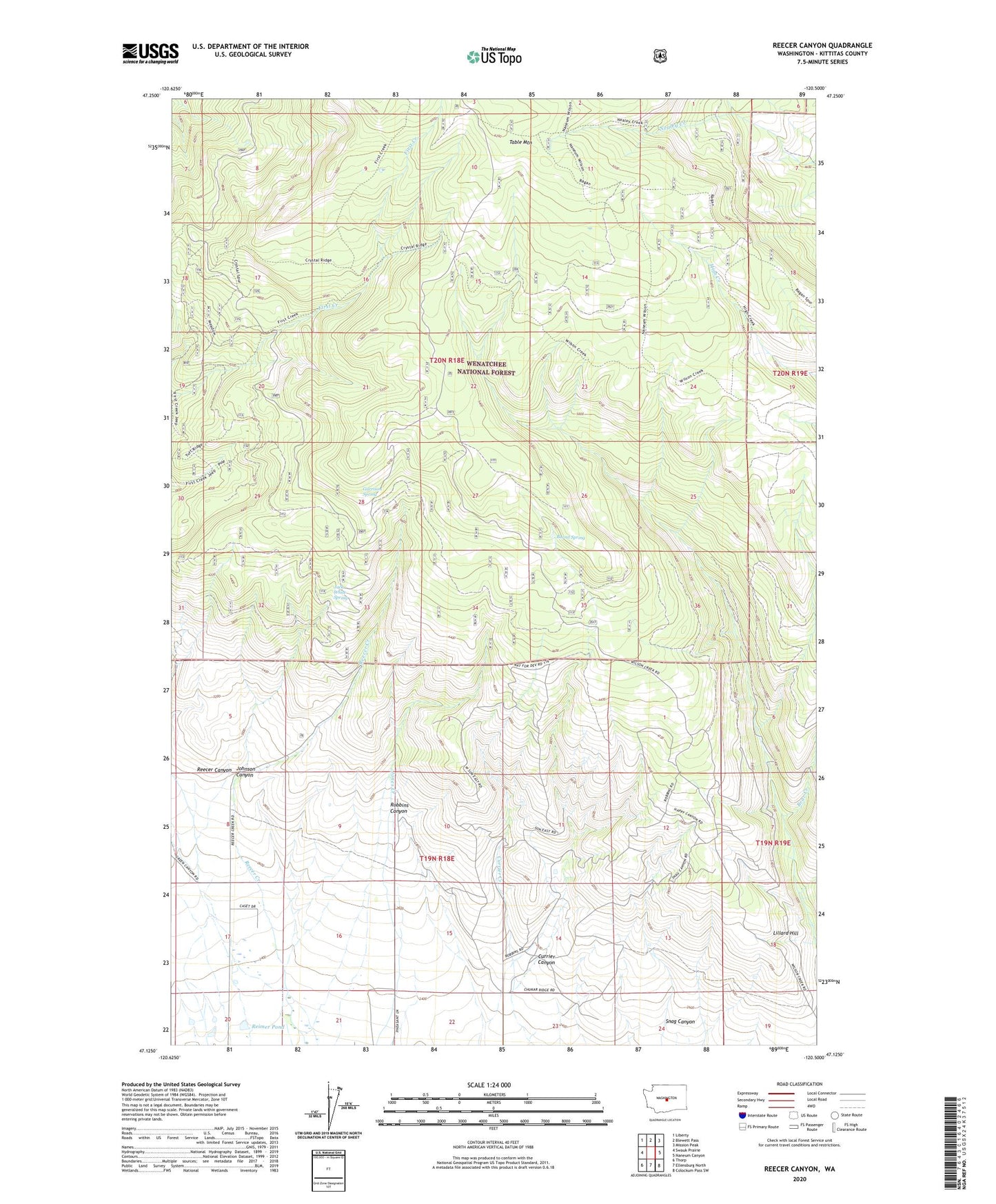
Reecer Canyon Washington US Topo Map
Couldn't load pickup availability
Also explore the Reecer Canyon Forest Service Topo of this same quad for updated USFS data
2023 topographic map quadrangle Reecer Canyon in the state of Washington. Scale: 1:24000. Based on the newly updated USGS 7.5' US Topo map series, this map is in the following counties: Kittitas. The map contains contour data, water features, and other items you are used to seeing on USGS maps, but also has updated roads and other features. This is the next generation of topographic maps. Printed on high-quality waterproof paper with UV fade-resistant inks.
Quads adjacent to this one:
West: Swauk Prairie
Northwest: Liberty
North: Blewett Pass
Northeast: Mission Peak
East: Naneum Canyon
Southeast: Colockum Pass SW
South: Ellensburg North
Southwest: Thorp
This map covers the same area as the classic USGS quad with code o47120b5.
Contains the following named places: Barrel Spring, Bear Creek, Currier Canyon, First Creek Trail, Garrison Spring, High Creek Trail, Jack White Spring, Johnson Canyon, Lillard Hill, Naneum Wilson Trail, Nealey Creek Trail, Ragan Way Trail, Reecer Canyon, Reimer Pond, Reimer Pond Dam, Riders Cabin, Robbins Canyon, Snag Canyon, Teanaway Wilson Stock Trail