MyTopo
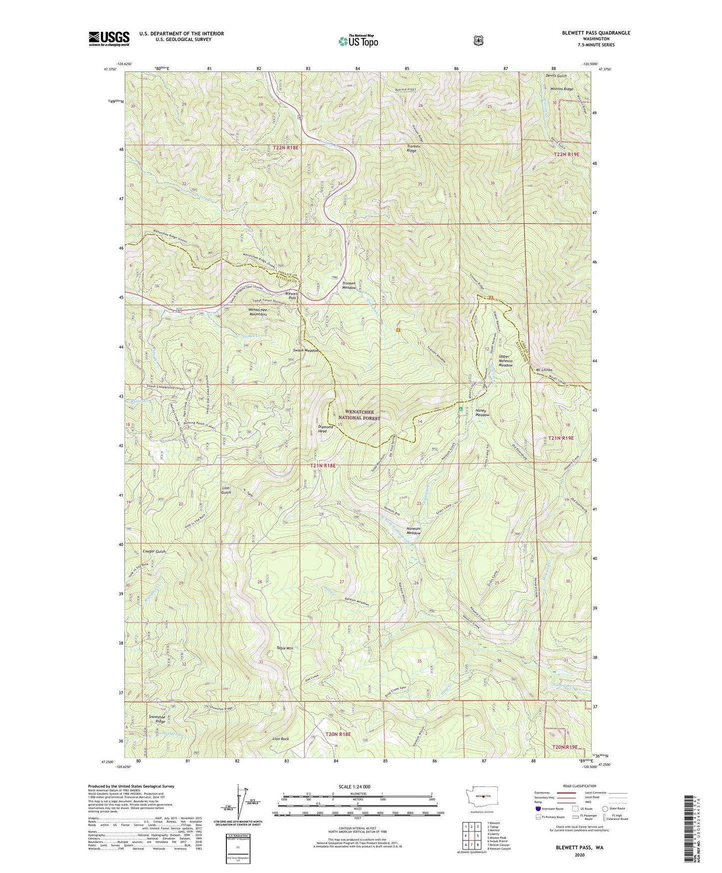
Blewett Pass Washington US Topo Map
Couldn't load pickup availability
Also explore the Blewett Pass Forest Service Topo of this same quad for updated USFS data
2023 topographic map quadrangle Blewett Pass in the state of Washington. Scale: 1:24000. Based on the newly updated USGS 7.5' US Topo map series, this map is in the following counties: Kittitas, Chelan. The map contains contour data, water features, and other items you are used to seeing on USGS maps, but also has updated roads and other features. This is the next generation of topographic maps. Printed on high-quality waterproof paper with UV fade-resistant inks.
Quads adjacent to this one:
West: Liberty
Northwest: Blewett
North: Tiptop
Northeast: Monitor
East: Mission Peak
Southeast: Naneum Canyon
South: Reecer Canyon
Southwest: Swauk Prairie
This map covers the same area as the classic USGS quad with code o47120c5.
Contains the following named places: Blewett Pass, Diamond Head, Drop Creek, Drop Creek Spur Trail, Haney Meadow, Haney Meadow Campground, Howard Creek, Howard Creek Trail, Lion Rock, Lion Rock Lookout, Lion Rock Spring Campground, Mount Lillian, Naneum Meadow, Naneum Meadow Trail, Old Ellensburg Trail, Owl Creek, Owl Creek Spur Trail, Pine Campground, Pipe Creek, Snowshoe Ridge, Stump Campground, Swauk Meadow, Swauk Pass Sno-Park, Swauk Ridge, Table Mountain, Tronsen Campground, Tronsen Creek Trail, Tronsen Meadow, Tronsen Ridge, Upper Naneum Meadow, West Fork Naneum Creek