MyTopo
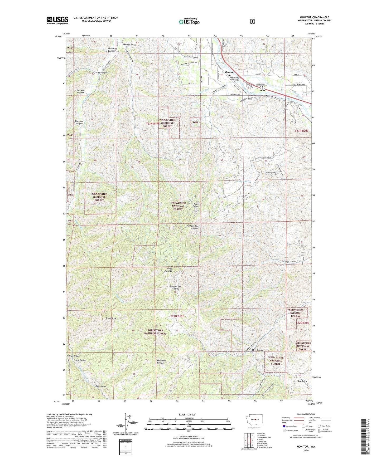
Monitor Washington US Topo Map
Couldn't load pickup availability
Also explore the Monitor Forest Service Topo of this same quad for updated USFS data
2023 topographic map quadrangle Monitor in the state of Washington. Scale: 1:24000. Based on the newly updated USGS 7.5' US Topo map series, this map is in the following counties: Chelan. The map contains contour data, water features, and other items you are used to seeing on USGS maps, but also has updated roads and other features. This is the next generation of topographic maps. Printed on high-quality waterproof paper with UV fade-resistant inks.
Quads adjacent to this one:
West: Tiptop
Northwest: Peshastin
North: Cashmere
Northeast: Rocky Reach Dam
East: Wenatchee
Southeast: Wenatchee Heights
South: Mission Peak
Southwest: Blewett Pass
This map covers the same area as the classic USGS quad with code o47120d4.
Contains the following named places: Bear Gulch, Crow Canyon, Fairview Canyon, Gunn Ditch, Horse Lake, Horse Lake Mountain, Monitor, Monitor Post Office, Monitor United Methodist Church, Old Monitor Road Bridge, Olive Ditch, Rag Canyon, Sheep Rock, Sherman Canyon, Shotwell Ditch, Slawson Canyon, Sties Canyon, Tripp Canyon, Wenatchee River County Park, Wenatchee River County Park Campground, Woodring Canyon, Yaksum Canyon, ZIP Codes: 98815, 98836