
MyTopo
Mount Annie Washington US Topo Map
Couldn't load pickup availability
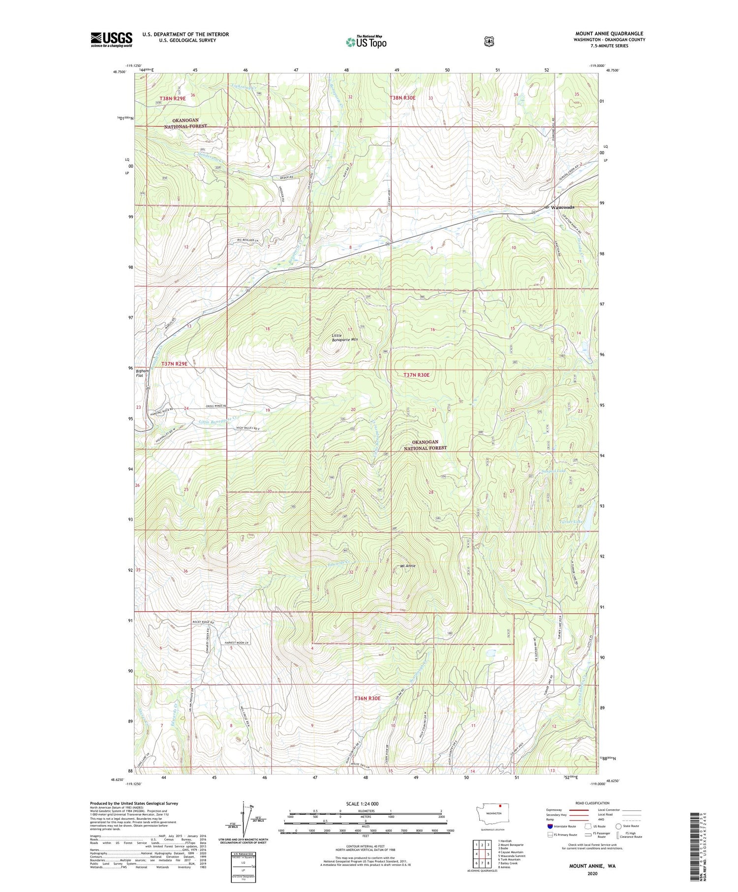
2020 topographic map quadrangle Mount Annie in the state of Washington. Scale: 1:24000. Based on the newly updated USGS 7.5' US Topo map series, this map is in the following counties: Okanogan. The map contains contour data, water features, and other items you are used to seeing on USGS maps, but also has updated roads and other features. This is the next generation of topographic maps. Printed on high-quality waterproof paper with UV fade-resistant inks.
Quads adjacent to this one:
West: Cayuse Mountain
Northwest: Havillah
North: Mount Bonaparte
Northeast: Bodie
East: Wauconda Summit
Southeast: Aeneas
South: Bailey Creek
Southwest: Tunk Mountain
Contains the following named places: Henderson Creek, Lightning Creek, Little Bonaparte Creek, Little Bonaparte Mountain, Mount Annie, Suttens Meadow, Toroda Creek, Turner Lake, Wauconda, Wauconda Post Office


