MyTopo
Mount Barney Washington US Topo Map
Couldn't load pickup availability
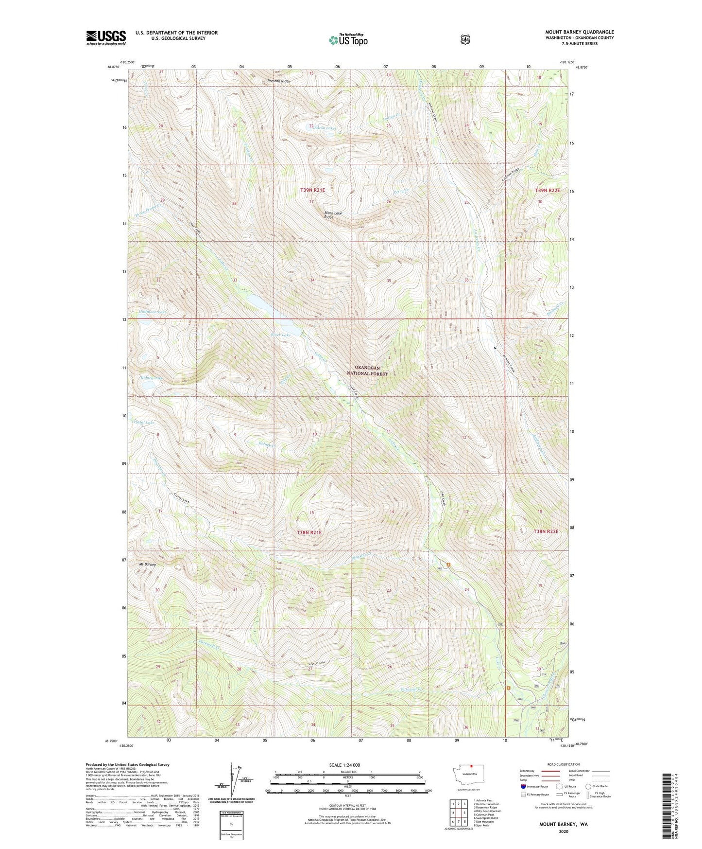
2020 topographic map quadrangle Mount Barney in the state of Washington. Scale: 1:24000. Based on the newly updated USGS 7.5' US Topo map series, this map is in the following counties: Okanogan. The map contains contour data, water features, and other items you are used to seeing on USGS maps, but also has updated roads and other features. This is the next generation of topographic maps. Printed on high-quality waterproof paper with UV fade-resistant inks.
Quads adjacent to this one:
West: Billy Goat Mountain
Northwest: Ashnola Pass
North: Remmel Mountain
Northeast: Bauerman Ridge
East: Coleman Peak
Southeast: Spur Peak
South: Doe Mountain
Southwest: Sweetgrass Butte
Contains the following named places: Black Lake, Black Lake Ridge, Blizzard Creek, Cold Creek, Crystal Lake, Disaster Creek, Dutton Creek, Dutton Lakes, Farewell Creek, Farewell Creek Trailhead, Halfmoon Lake, Kidney Creek, Kidney Lake, Lake Creek, Lake Creek Trailhead, Mount Barney, Perry Creek, Preston Creek, Preston Ridge, Ram Creek, Three Prong Creek