
MyTopo
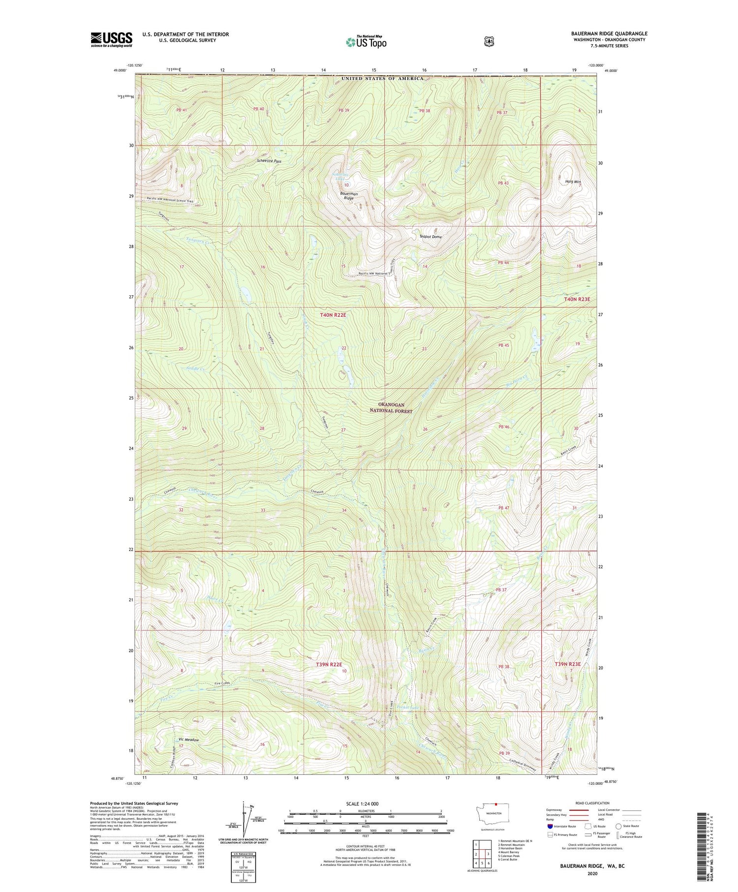
Bauerman Ridge Washington US Topo Map
Couldn't load pickup availability
Also explore the Bauerman Ridge Forest Service Topo of this same quad for updated USFS data
2023 topographic map quadrangle Bauerman Ridge in the state of Washington. Scale: 1:24000. Based on the newly updated USGS 7.5' US Topo map series, this map is in the following counties: Okanogan. The map contains contour data, water features, and other items you are used to seeing on USGS maps, but also has updated roads and other features. This is the next generation of topographic maps. Printed on high-quality waterproof paper with UV fade-resistant inks.
Quads adjacent to this one:
West: Remmel Mountain
Northwest: Remmel Mountain OE N
East: Horseshoe Basin
Southeast: Corral Butte
South: Coleman Peak
Southwest: Mount Barney
This map covers the same area as the classic USGS quad with code o48120h1.
Contains the following named places: Basin Creek, Bauerman Ridge, Big Horn Creek, Cinch Creek, Dome Camp, Fire Creek, Haig Mountain, Horseshoe Creek, Pocket Lake, Saddle Creek, Scheelite Lake, Scheelite Pass, Teapot Dome, Tungsten Creek, Vic Meadow, Wave Creek


