MyTopo
Remmel Mountain Washington US Topo Map
Couldn't load pickup availability
Also explore the Remmel Mountain Forest Service Topo of this same quad for updated USFS data
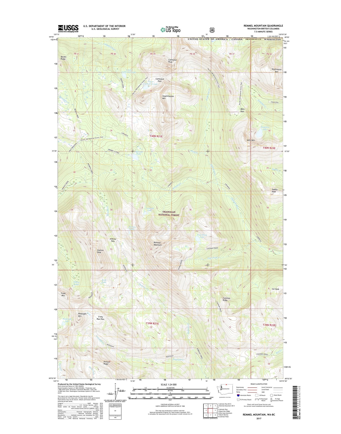
2023 topographic map quadrangle Remmel Mountain in the state of Washington. Scale: 1:24000. Based on the newly updated USGS 7.5' US Topo map series, this map is in the following counties: Okanogan. The map contains contour data, water features, and other items you are used to seeing on USGS maps, but also has updated roads and other features. This is the next generation of topographic maps. Printed on high-quality waterproof paper with UV fade-resistant inks.
Quads adjacent to this one:
West: Ashnola Pass
Northwest: Ashnola Pass OE N
North: Remmel Mountain OE N
East: Bauerman Ridge
Southeast: Coleman Peak
South: Mount Barney
Southwest: Billy Goat Mountain
This map covers the same area as the classic USGS quad with code o48120h2.
Contains the following named places: Airview Lake, Amphitheater Mountain, Andrew Pass, Andrew Peak, Apex Mountain, Apex Pass, Border Ridge, Cal Peak, Cathedral Creek, Cathedral Lakes, Cathedral Pass, Cathedral Peak, Coleman Ridge, Cornwell Lake, Crazy Man Pass, Four Point Creek, Four Point Lake, Glory Lake, Hazel Creek, Lower Cathedral Lake, Peepsight Creek, Peepsight Lake, Peepsight Mountain, Remmel Creek, Remmel Lake, Remmel Mountain, Rock Lake, Saddle Peak, Tungsten Lake, Upper Cathedral Lake, Wolframite Mountain