
MyTopo
Mount Hull Washington US Topo Map
Couldn't load pickup availability
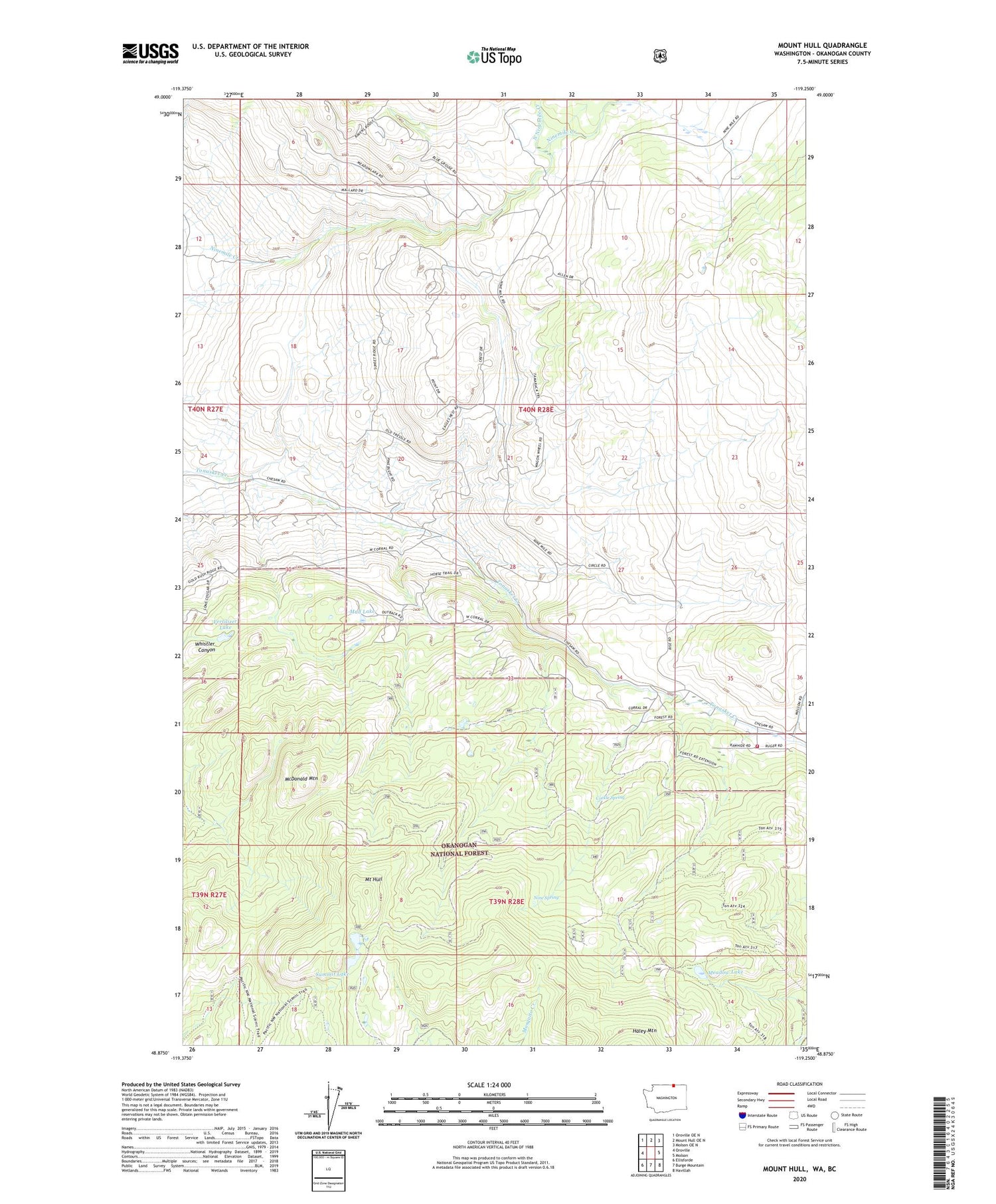
2020 topographic map quadrangle Mount Hull in the state of Washington. Scale: 1:24000. Based on the newly updated USGS 7.5' US Topo map series, this map is in the following counties: Okanogan. The map contains contour data, water features, and other items you are used to seeing on USGS maps, but also has updated roads and other features. This is the next generation of topographic maps. Printed on high-quality waterproof paper with UV fade-resistant inks.
Quads adjacent to this one:
West: Oroville
Northwest: Oroville OE N
North: Mount Hull OE N
Northeast: Molson OE N
East: Molson
Southeast: Havillah
South: Burge Mountain
Southwest: Ellisforde
Contains the following named places: Big Mack Lake, Circle, Cockle Spring, Dickson Field Airport, Fertilizer Lake, McDonald Mountain, Meadow Lake, Mount Hull, Mud Lake, Nine Spring, North Ninemile Creek, Okanogan County Fire District 11 Rawhide, Summit Lake


