MyTopo
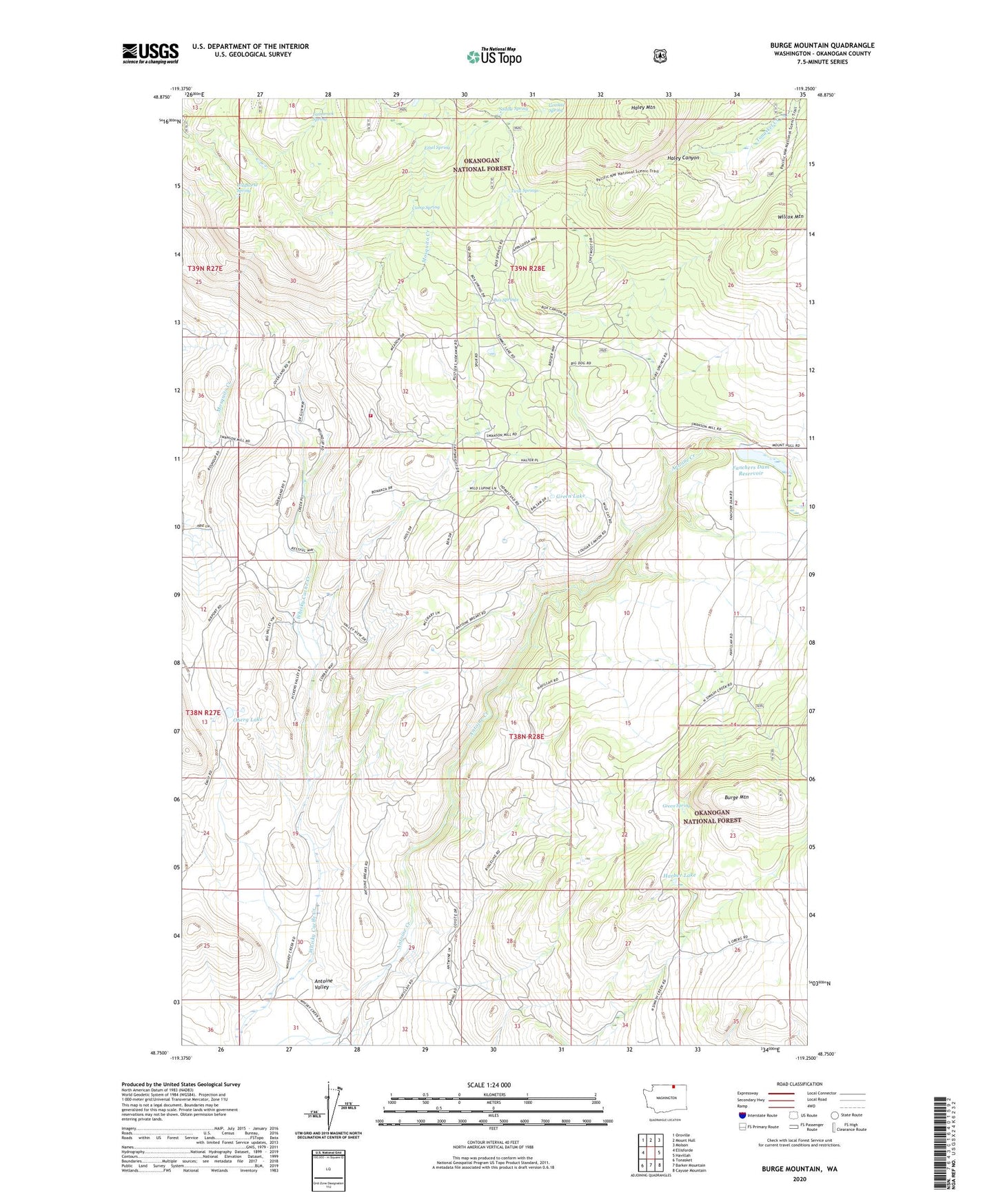
Burge Mountain Washington US Topo Map
Couldn't load pickup availability
Also explore the Burge Mountain Forest Service Topo of this same quad for updated USFS data
2023 topographic map quadrangle Burge Mountain in the state of Washington. Scale: 1:24000. Based on the newly updated USGS 7.5' US Topo map series, this map is in the following counties: Okanogan. The map contains contour data, water features, and other items you are used to seeing on USGS maps, but also has updated roads and other features. This is the next generation of topographic maps. Printed on high-quality waterproof paper with UV fade-resistant inks.
Quads adjacent to this one:
West: Ellisforde
Northwest: Oroville
North: Mount Hull
Northeast: Molson
East: Havillah
Southeast: Cayuse Mountain
South: Barker Mountain
Southwest: Tonasket
This map covers the same area as the classic USGS quad with code o48119g3.
Contains the following named places: Box Springs, Burge Mountain, Camp Spring, Ethel Spring, Fancher Quarry, Fanchers Dam, Fanchers Dam Reservoir, Granite Spring, Green Lake, Green Spring, Haley Mountain, Harbor Lake, Oberg Lake, Okanogan County Fire District 12 Havillah, Oroville Division, Saddle Spring, Tamarack Spring, Twin Springs, Wilcox Mountain, Wildhorse Spring