MyTopo
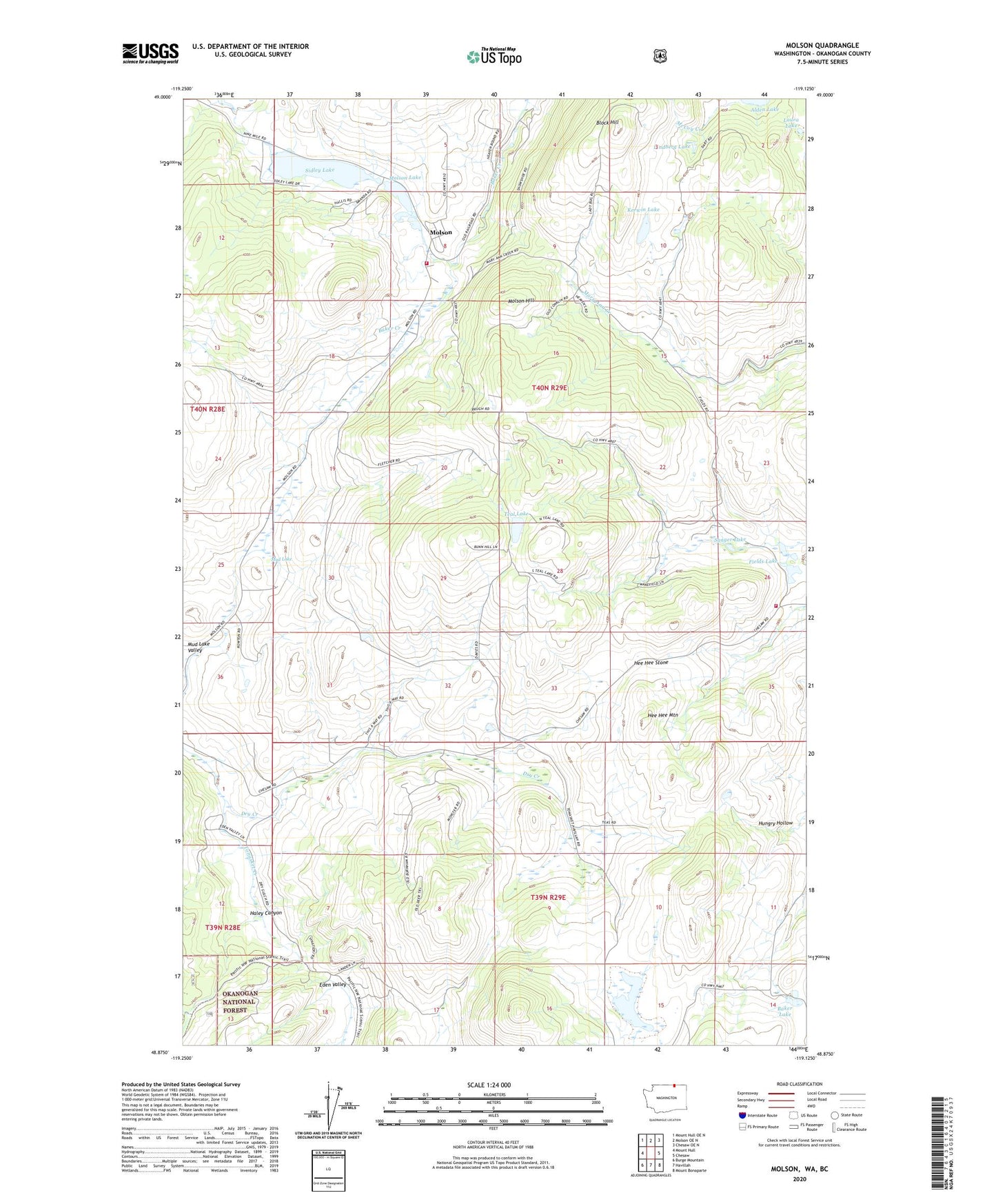
Molson Washington US Topo Map
Couldn't load pickup availability
Also explore the Molson Forest Service Topo of this same quad for updated USFS data
2023 topographic map quadrangle Molson in the state of Washington. Scale: 1:24000. Based on the newly updated USGS 7.5' US Topo map series, this map is in the following counties: Okanogan. The map contains contour data, water features, and other items you are used to seeing on USGS maps, but also has updated roads and other features. This is the next generation of topographic maps. Printed on high-quality waterproof paper with UV fade-resistant inks.
Quads adjacent to this one:
West: Mount Hull
Northwest: Mount Hull OE N
North: Molson OE N
Northeast: Chesaw OE N
East: Chesaw
Southeast: Mount Bonaparte
South: Havillah
Southwest: Burge Mountain
This map covers the same area as the classic USGS quad with code o48119h2.
Contains the following named places: Alden Lake, Baker Lake, Block Hill, Dry Creek, Fields Lake, Haley Canyon, Hee Hee Mountain, Hee Hee Stone, Kerwin Lake, Kipling, Knobhill Grange, Laura Lake, Lindberg Lake, Molson, Molson Hill, Molson Lake, Molson Museum, Mud Lake Valley, Muskrat Lake, Okanogan County Fire District 11 Fields, Okanogan County Fire District 11 Molson, Old Molson, Sanger Lake, Sidley Lake, Teal Lake, ZIP Code: 98844