MyTopo
Mount Queets Washington US Topo Map
Couldn't load pickup availability
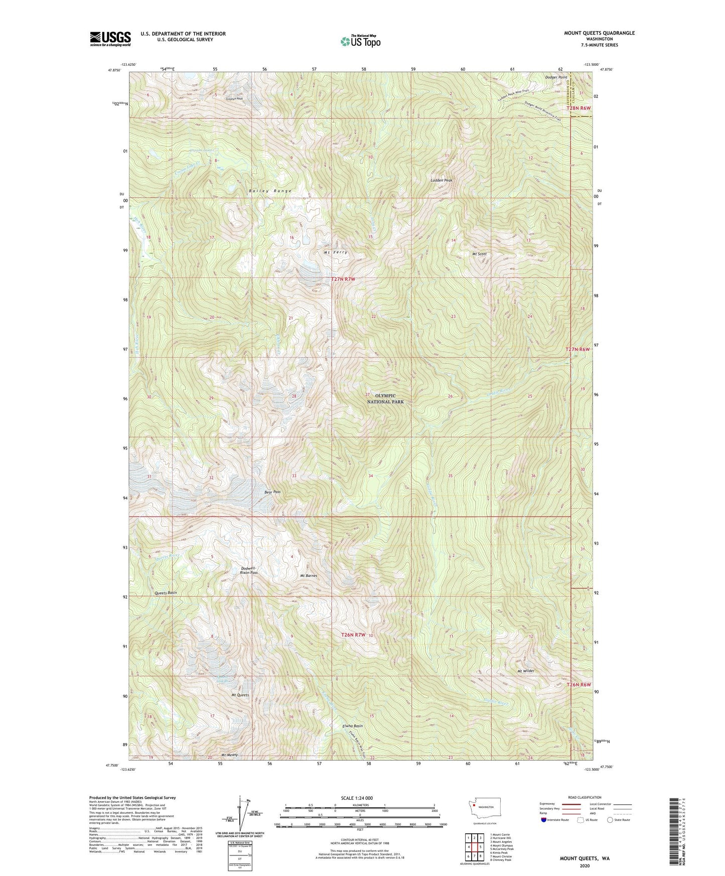
2020 topographic map quadrangle Mount Queets in the state of Washington. Scale: 1:24000. Based on the newly updated USGS 7.5' US Topo map series, this map is in the following counties: Jefferson, Clallam. The map contains contour data, water features, and other items you are used to seeing on USGS maps, but also has updated roads and other features. This is the next generation of topographic maps. Printed on high-quality waterproof paper with UV fade-resistant inks.
Quads adjacent to this one:
West: Mount Olympus
Northwest: Mount Carrie
North: Hurricane Hill
Northeast: Mount Angeles
East: McCartney Peak
Southeast: Chimney Peak
South: Mount Christie
Southwest: Kimta Peak
Contains the following named places: Bailey Range, Bear Pass, Cream Lake, Cream Lake Creek, Dodger Point, Dodwell-Rixon Pass, Elkhorn Creek, Elwha Basin, Jefferson County, Ludden Peak, Mount Barnes, Mount Ferry, Mount Meany, Mount Queets, Mount Scott, Mount Wilder, Queets Basin, Queets Glacier, Stephen Peak