MyTopo
Chimney Peak Washington US Topo Map
Couldn't load pickup availability
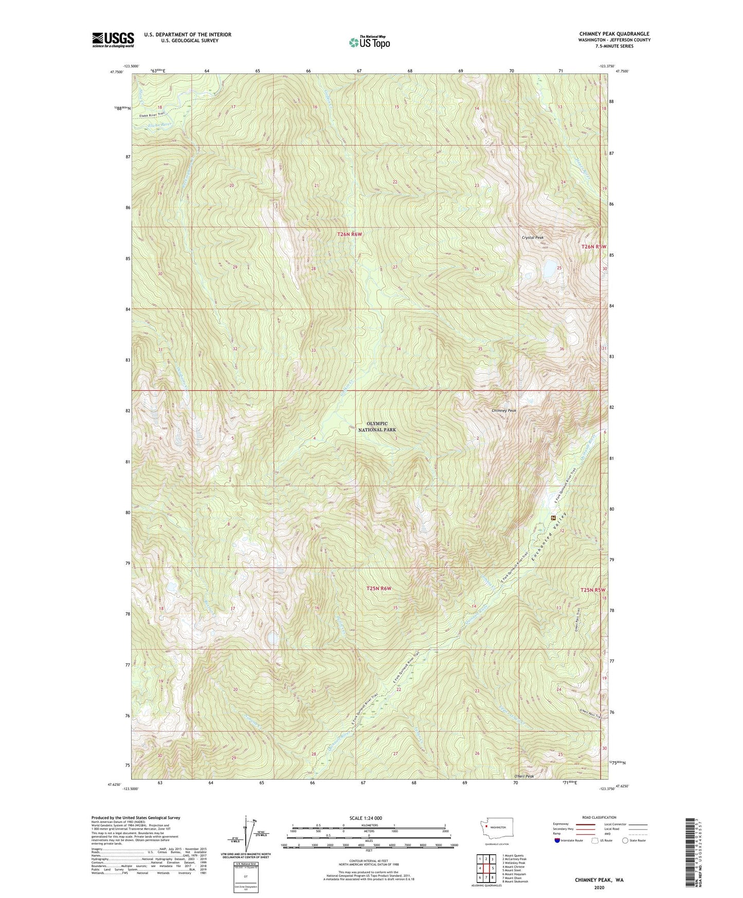
2023 topographic map quadrangle Chimney Peak in the state of Washington. Scale: 1:24000. Based on the newly updated USGS 7.5' US Topo map series, this map is in the following counties: Jefferson. The map contains contour data, water features, and other items you are used to seeing on USGS maps, but also has updated roads and other features. This is the next generation of topographic maps. Printed on high-quality waterproof paper with UV fade-resistant inks.
Quads adjacent to this one:
West: Mount Christie
Northwest: Mount Queets
North: McCartney Peak
Northeast: Wellesley Peak
East: Mount Steel
Southeast: Mount Skokomish
South: Mount Olson
Southwest: Mount Hoquiam
This map covers the same area as the classic USGS quad with code o47123f4.
Contains the following named places: Buckinghorse Creek, Chimney Peak, Crystal Peak, Enchanted Valley, Enchanted Valley Ranger Station, Enchantment Valley Ranger Station, Ignar Creek, Lamata Creek, Noname Creek, Pyrites Creek, Slate Creek, Upper O'Neil Creek