
MyTopo
Mount Spickard Washington US Topo Map
Couldn't load pickup availability
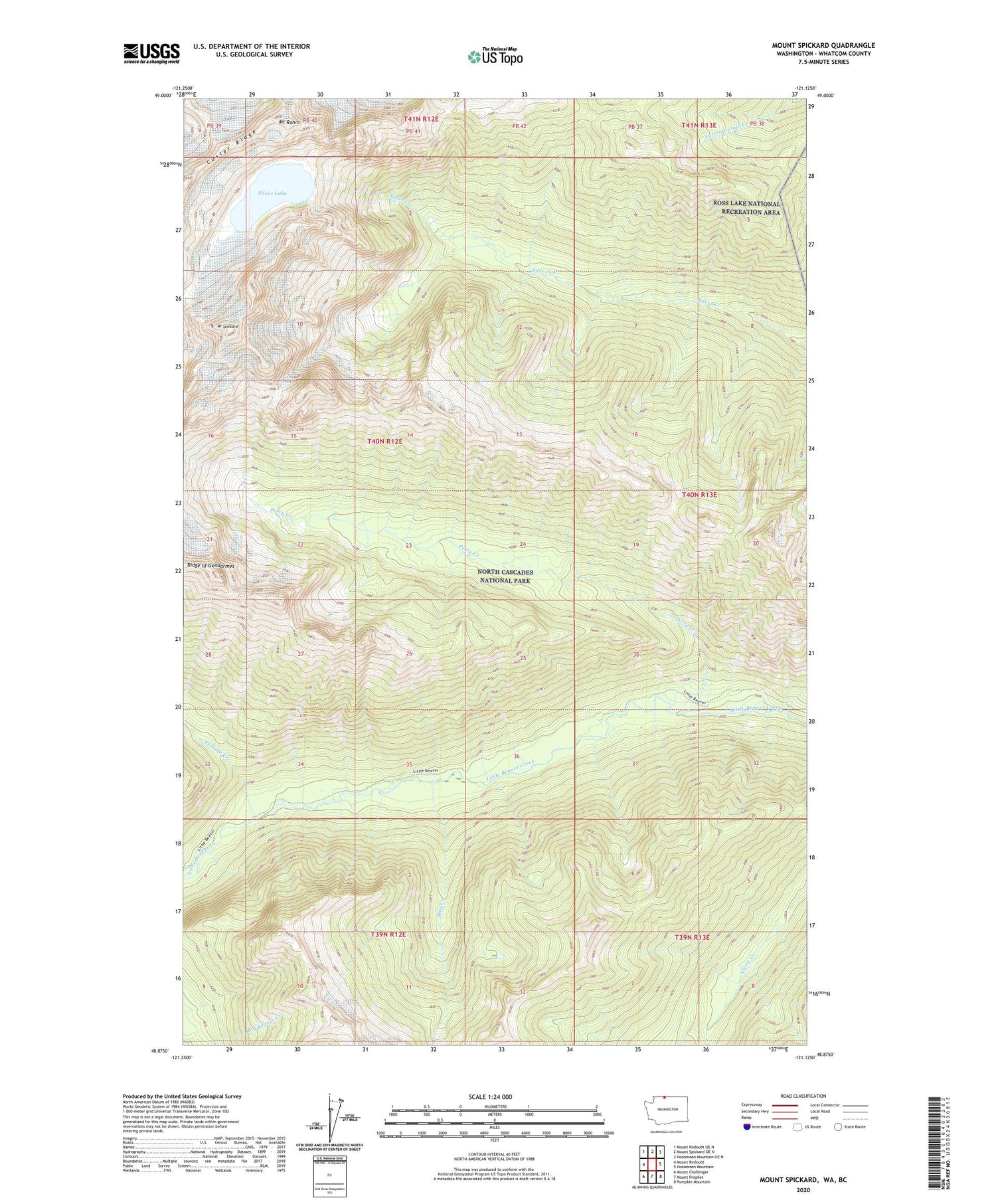
2023 topographic map quadrangle Mount Spickard in the state of Washington. Scale: 1:24000. Based on the newly updated USGS 7.5' US Topo map series, this map is in the following counties: Whatcom. The map contains contour data, water features, and other items you are used to seeing on USGS maps, but also has updated roads and other features. This is the next generation of topographic maps. Printed on high-quality waterproof paper with UV fade-resistant inks.
Quads adjacent to this one:
West: Mount Redoubt
Northwest: Mount Redoubt OE N
North: Mount Spickard OE N
Northeast: Hozomeen Mountain OE N
East: Hozomeen Mountain
Southeast: Pumpkin Mountain
South: Mount Prophet
Southwest: Mount Challenger
This map covers the same area as the classic USGS quad with code o48121h2.
Contains the following named places: Custer Ridge, Mist Creek, Mount Rahm, Mount Spickard, Perry Creek, Perry Creek Shelter, Redoubt Creek, Silver Lake


