MyTopo
Rochester Washington US Topo Map
Couldn't load pickup availability
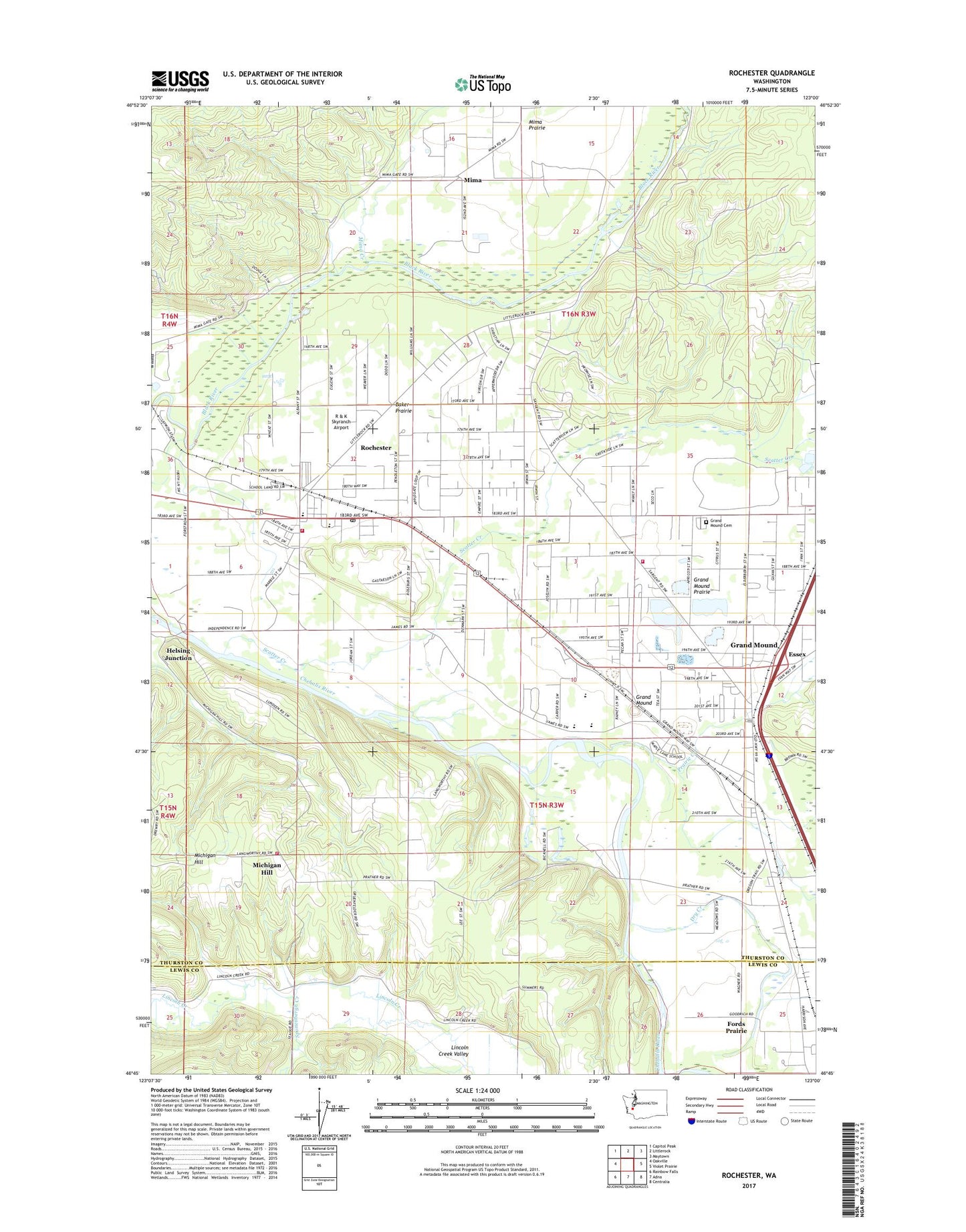
2023 topographic map quadrangle Rochester in the state of Washington. Scale: 1:24000. Based on the newly updated USGS 7.5' US Topo map series, this map is in the following counties: Thurston, Lewis. The map contains contour data, water features, and other items you are used to seeing on USGS maps, but also has updated roads and other features. This is the next generation of topographic maps. Printed on high-quality waterproof paper with UV fade-resistant inks.
Quads adjacent to this one:
West: Oakville
Northwest: Capitol Peak
North: Littlerock
Northeast: Maytown
East: Violet Prairie
Southeast: Centralia
South: Adna
Southwest: Rainbow Falls
This map covers the same area as the classic USGS quad with code o46123g1.
Contains the following named places: Baker Prairie, Black River Habitat Management Area, Crossroads Foursquare Church, Dry Creek, Essex, Grand Mound, Grand Mound Cemetery, Grand Mound Census Designated Place, Grand Mound Elementary School, Grand Mound State Game Reserve, Ground Mound Middle School, Helsing Junction, Historical Marker Fort Henness Site, Maple Lane High School, Meadows, Michigan Hill, Mima, Mima Creek, Peterson Corner, Prairie Creek, R & K Skyranch Airport, Rochester, Rochester Census Designated Place, Rochester Elementary School, Rochester High School, Rochester Life Assembly of God Church, Rochester Post Office, Rochester United Methodist Church, Scatter Creek, Scatter Creek Wildlife Recreation Area, Shaner Creek, Skatter Creek Airport, Sponenbergh Creek, The Church of Jesus Christ of Latter Day Saints, West Thurston Regional Fire Authority South Battalion Station 1 - 1 Grand Mound, West Thurston Regional Fire Authority South Battalion Station 1 - 3 Rochester, West Thurston Regional Fire Authority South Battalion Station 1 - 5 Michigan Hill