
MyTopo
Omak Lake Washington US Topo Map
Couldn't load pickup availability
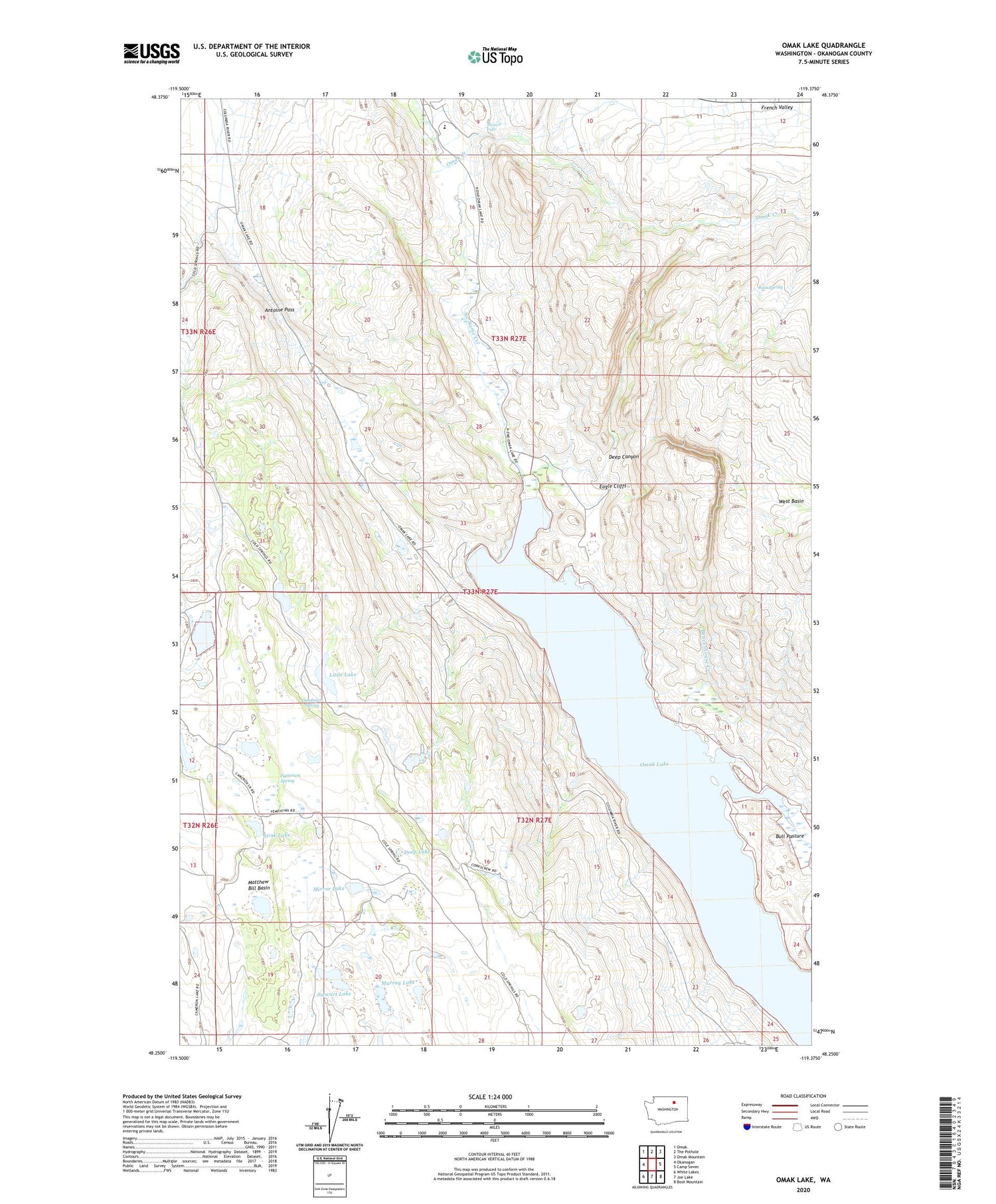
2020 topographic map quadrangle Omak Lake in the state of Washington. Scale: 1:24000. Based on the newly updated USGS 7.5' US Topo map series, this map is in the following counties: Okanogan. The map contains contour data, water features, and other items you are used to seeing on USGS maps, but also has updated roads and other features. This is the next generation of topographic maps. Printed on high-quality waterproof paper with UV fade-resistant inks.
Quads adjacent to this one:
West: Okanogan
Northwest: Omak
North: The Pothole
Northeast: Omak Mountain
East: Camp Seven
Southeast: Boot Mountain
South: Joe Lake
Southwest: White Lakes
Contains the following named places: Antoine Pass, Beaverhouse Creek, Bull Pasture, Deadman Spring, Deep Canyon, Deep Lake, Eagle Cliffs, Little Lake, Matthew Bill Basin, Mirror Lake, Mission Falls, Murray Lake, No Name Creek, Omak Lake, Paschal Sherman Indian School, Patterson Lake, Patterson Spring, Rust Spring, Saint Marys Farm, Saint Marys Mission, Stewart Lake, Stink Lake, West Basin


