MyTopo
The Pothole Washington US Topo Map
Couldn't load pickup availability
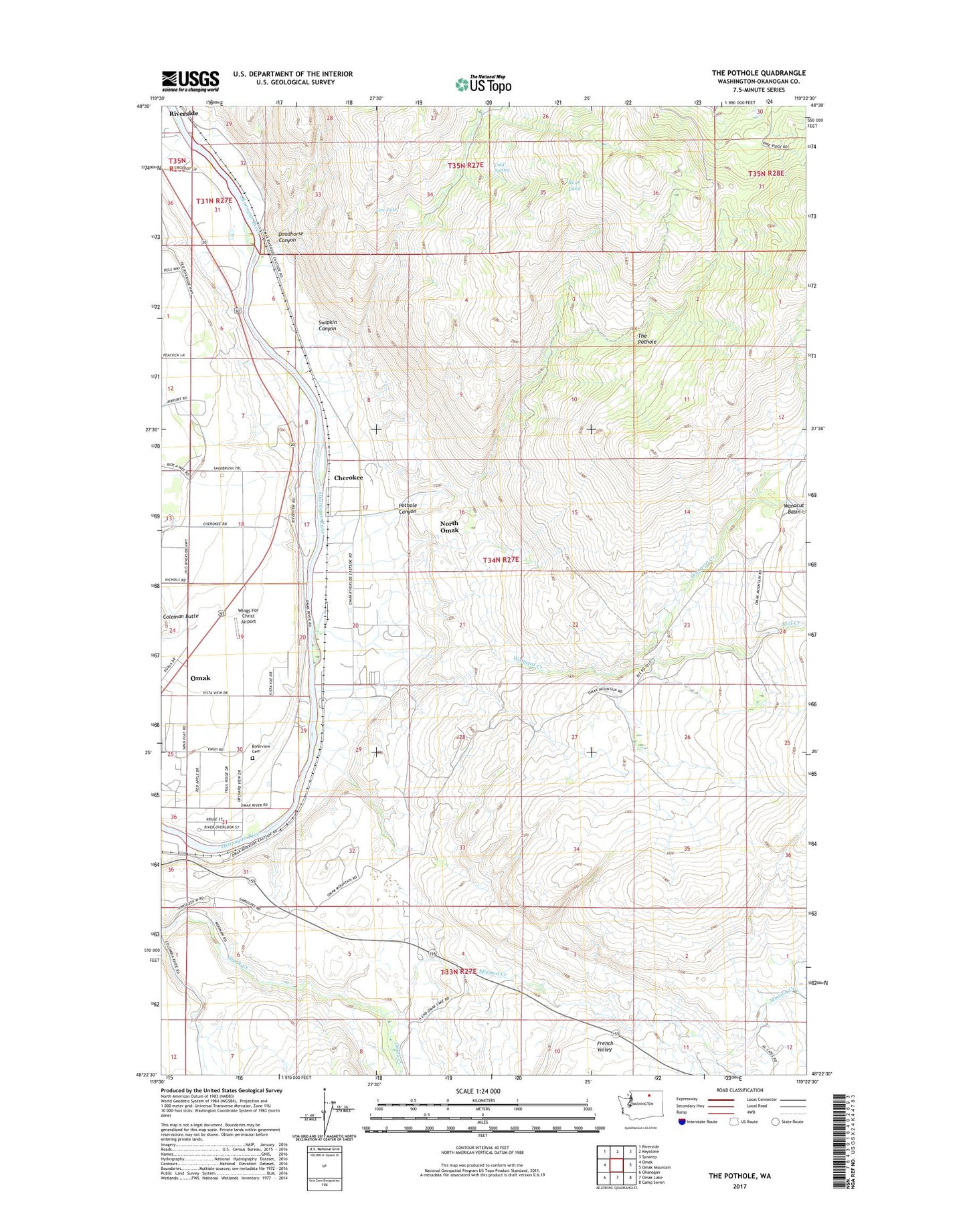
2023 topographic map quadrangle The Pothole in the state of Washington. Scale: 1:24000. Based on the newly updated USGS 7.5' US Topo map series, this map is in the following counties: Okanogan. The map contains contour data, water features, and other items you are used to seeing on USGS maps, but also has updated roads and other features. This is the next generation of topographic maps. Printed on high-quality waterproof paper with UV fade-resistant inks.
Quads adjacent to this one:
West: Omak
Northwest: Riverside
North: Keystone
Northeast: Synarep
East: Omak Mountain
Southeast: Camp Seven
South: Omak Lake
Southwest: Okanogan
This map covers the same area as the classic USGS quad with code o48119d4.
Contains the following named places: Bear Lake, Cherokee, Cold Spring, Country Estates Mobile Home Park, Cow Lake, Deadhorse Canyon, French Valley, Greenacres Quarry, Mill Creek, Mission Creek, North Omak, North Omak Census Designated Place, Pothole Canyon, Providence Orchards, Sand Flats Cemetery, Swipkin Canyon, The Pothole, Wanacut Creek, Wings For Christ Airport