MyTopo
Omak Mountain Washington US Topo Map
Couldn't load pickup availability
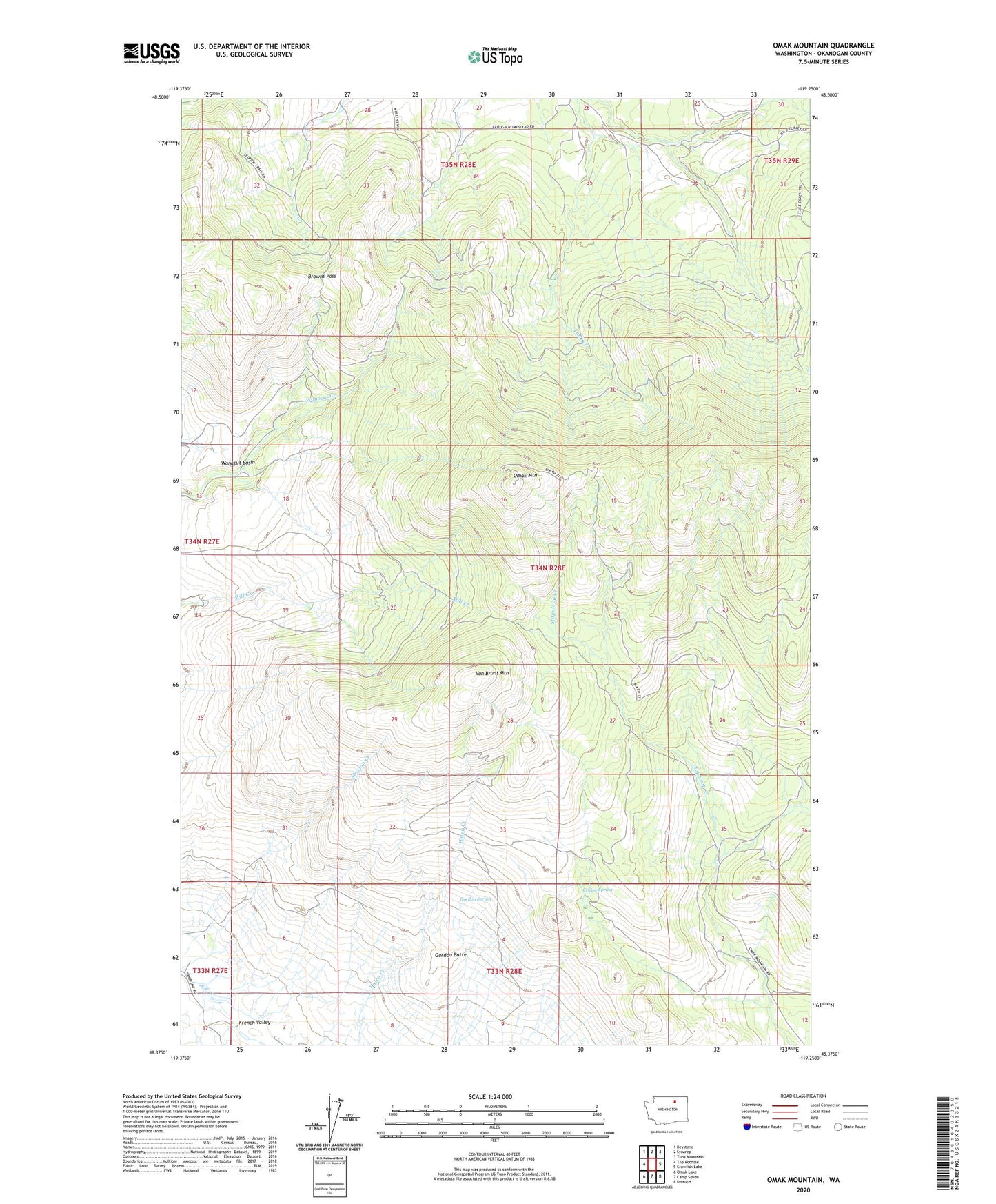
2023 topographic map quadrangle Omak Mountain in the state of Washington. Scale: 1:24000. Based on the newly updated USGS 7.5' US Topo map series, this map is in the following counties: Okanogan. The map contains contour data, water features, and other items you are used to seeing on USGS maps, but also has updated roads and other features. This is the next generation of topographic maps. Printed on high-quality waterproof paper with UV fade-resistant inks.
Quads adjacent to this one:
West: The Pothole
Northwest: Keystone
North: Synarep
Northeast: Tunk Mountain
East: Crawfish Lake
Southeast: Disautel
South: Camp Seven
Southwest: Omak Lake
This map covers the same area as the classic USGS quad with code o48119d3.
Contains the following named places: Browns Pass, Crusoe Spring, Gordon Butte, Gordon Spring, Omak Mountain, Van Brunt Mountain, Wanacut Basin