MyTopo
Oman Ranch Washington US Topo Map
Couldn't load pickup availability
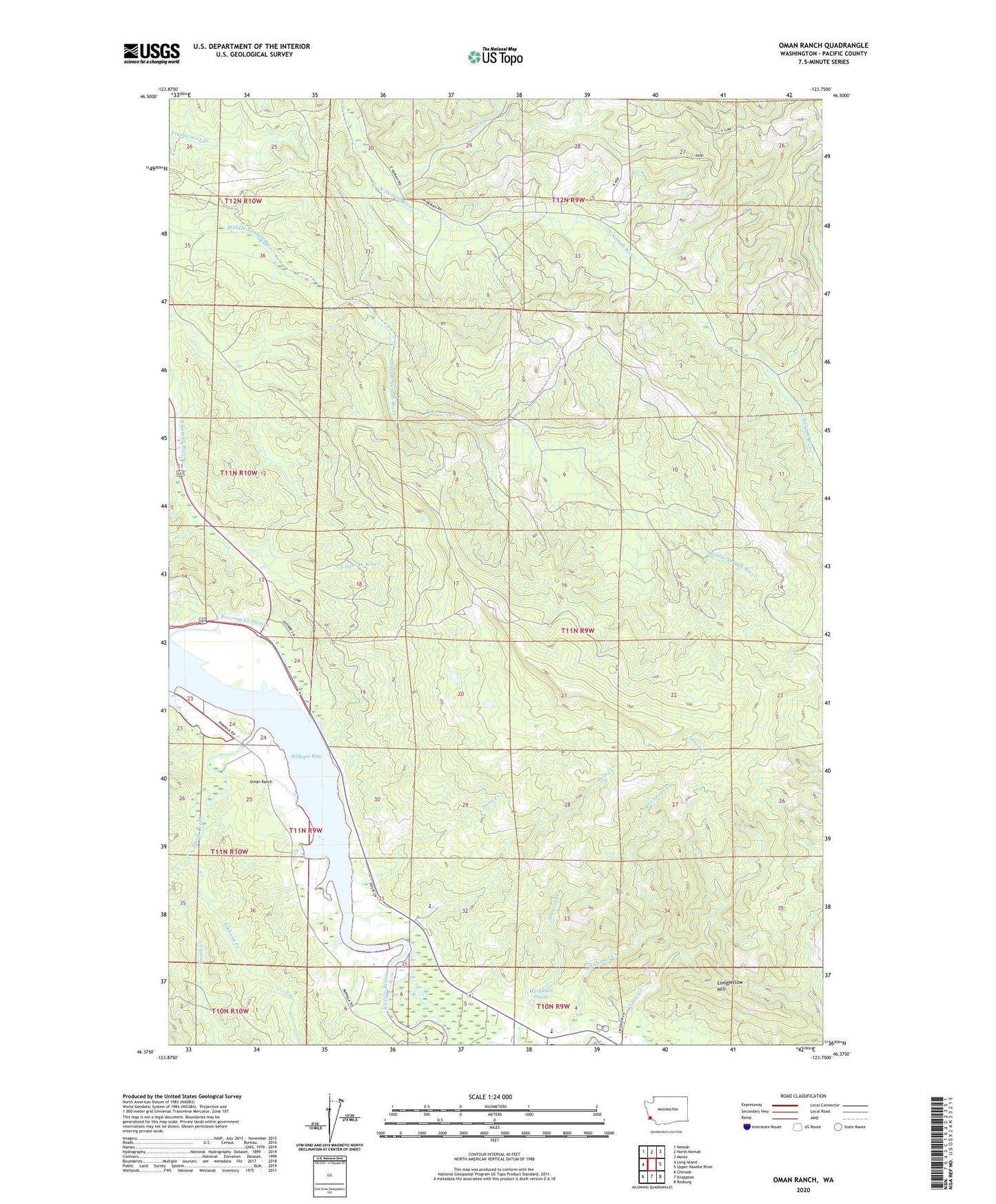
2020 topographic map quadrangle Oman Ranch in the state of Washington. Scale: 1:24000. Based on the newly updated USGS 7.5' US Topo map series, this map is in the following counties: Pacific. The map contains contour data, water features, and other items you are used to seeing on USGS maps, but also has updated roads and other features. This is the next generation of topographic maps. Printed on high-quality waterproof paper with UV fade-resistant inks.
Quads adjacent to this one:
West: Long Island
Northwest: Nemah
North: North Nemah
Northeast: Menlo
East: Upper Naselle River
Southeast: Rosburg
South: Knappton
Southwest: Chinook
Contains the following named places: Cowan Peak Lookout, Elkhorn Creek, Finn Creek, Holm Creek, Holm Ranch, Johnsons Landing, Longfellow Hill, Naselle - Grays River Valley Elementary School, Naselle Air Force Station, Naselle Quarry, Naselle State Salmon Hatchery, Naselle Substation, Naselle Youth Camp School, Oman Ranch, Parpala Ranch, Petes Creek, Ring Ranch, Roaring Creek Slough, S Ring Ranch, Silvola Ranch, Smith Creek, Wirkkala Dam Number One, Wirkkala Dam Number Two, Wirkkala Ponds, ZIP Code: 98638