MyTopo
Menlo Washington US Topo Map
Couldn't load pickup availability
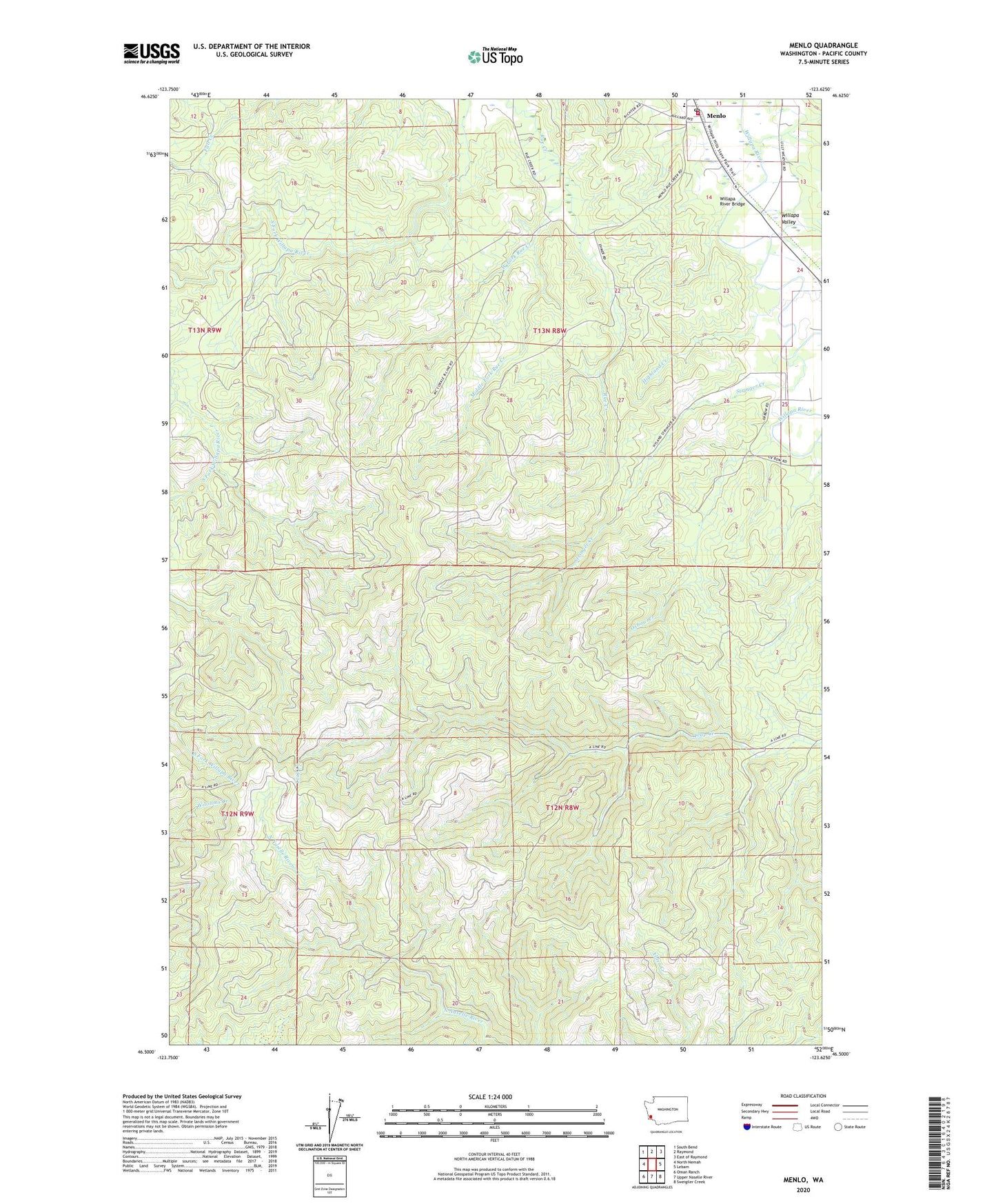
2023 topographic map quadrangle Menlo in the state of Washington. Scale: 1:24000. Based on the newly updated USGS 7.5' US Topo map series, this map is in the following counties: Pacific. The map contains contour data, water features, and other items you are used to seeing on USGS maps, but also has updated roads and other features. This is the next generation of topographic maps. Printed on high-quality waterproof paper with UV fade-resistant inks.
Quads adjacent to this one:
West: North Nemah
Northwest: South Bend
North: Raymond
Northeast: East of Raymond
East: Lebam
Southeast: Sweigiler Creek
South: Upper Naselle River
Southwest: Oman Ranch
This map covers the same area as the classic USGS quad with code o46123e6.
Contains the following named places: Highland Creek, Menlo, Menlo Middle School, Menlo Post Office, Middle Fork Rue Creek, Oxbow Creek, Pacific County Fire District 3, Stringer Creek, Trap Creek Lookout, West Fork Rue Creek, Willapa River Bridge, Willapa Valley Middle - High School