MyTopo
Long Island Washington US Topo Map
Couldn't load pickup availability
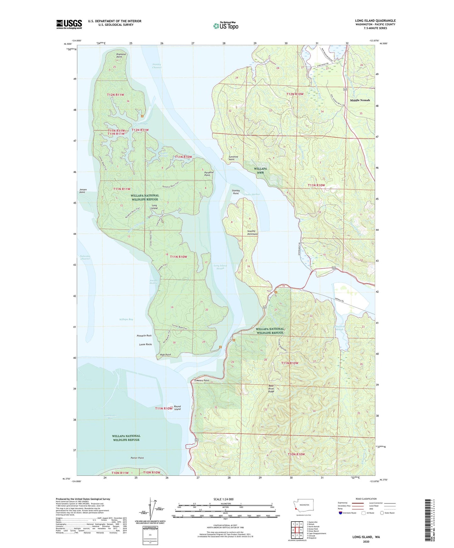
2023 topographic map quadrangle Long Island in the state of Washington. Scale: 1:24000. Based on the newly updated USGS 7.5' US Topo map series, this map is in the following counties: Pacific. The map contains contour data, water features, and other items you are used to seeing on USGS maps, but also has updated roads and other features. This is the next generation of topographic maps. Printed on high-quality waterproof paper with UV fade-resistant inks.
Quads adjacent to this one:
West: Ocean Park
Northwest: Oysterville
North: Nemah
Northeast: North Nemah
East: Oman Ranch
Southeast: Knappton
South: Chinook
Southwest: Cape Disappointment
This map covers the same area as the classic USGS quad with code o46123d8.
Contains the following named places: Baldwin Slough, Chetlo Harbor, Clearwater Creek, Diamond Point, Ellsworth Creek, Ellsworth Slough, High Point, Kaffee Slough, Lagergren Ranch, Lewis Slough, Long Island, Long Island Slough, Louse Rocks, Middle Nemah, Mill Ranch, Naselle River, O'Meara Point, Paradise Point, Pinnacle Rock, Porter Point, Reef Ranch, Refuge Display Pool Dam, Round Island, Seal Slough, Shoalwater Bay, Smoky Hollow, Stanley Channel, Stanley Peninsula, Stanley Point, Sunshine, Sunshine Point, Teal Slough, Templin Quarry, Willapa National Wildlife Refuge