MyTopo
Rosburg Washington US Topo Map
Couldn't load pickup availability
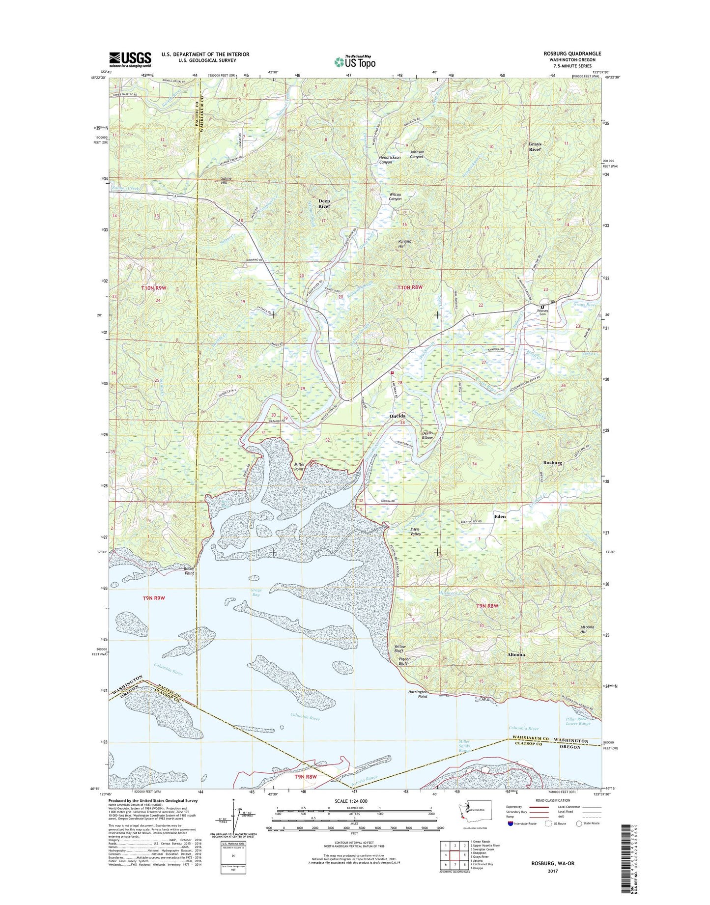
2023 topographic map quadrangle Rosburg in the states of Washington, Oregon. Scale: 1:24000. Based on the newly updated USGS 7.5' US Topo map series, this map is in the following counties: Wahkiakum, Pacific, Clatsop. The map contains contour data, water features, and other items you are used to seeing on USGS maps, but also has updated roads and other features. This is the next generation of topographic maps. Printed on high-quality waterproof paper with UV fade-resistant inks.
Quads adjacent to this one:
West: Knappton
Northwest: Oman Ranch
North: Upper Naselle River
Northeast: Sweigiler Creek
East: Grays River
Southeast: Knappa
South: Cathlamet Bay
Southwest: Astoria
This map covers the same area as the classic USGS quad with code o46123c6.
Contains the following named places: Altoona, Altoona Hill, Brix Bay, Camp Brix, Campbell Creek, Cannery Light, Carlson Landing, Crooked Creek, Deep River, Deep River Census Designated Place, Devils Elbow, Eden, Eden Valley, Empi Creek, Frank Born Creek, Grays Bay, Grays Bay Light, Grays River, Grays River Valley Middle School, Halaya Slough, Harrington Point, Heldt Creek, Hendrickson Canyon, Hendrickson Creek, Hitchcock Creek, Johnson Canyon, Johnson Ranch, Lassila Creek, Malone Creek, Miller Point, Miller Sands Range, Nikka Creek, Old Camp Brix, Oneida, Person Creek, Pigeon Bluff, Rangila Hill, Rangila Slough, Rocky Point, Rocky Point Light, Rosburg, Rosburg Cemetery, Rosburg Census Designated Place, Rosburg Community Hall, Rosburg Post Office, Salme Creek, Salme Hill, Seal Creek, Seal Slough, Sisson Creek, South Creek, Svensens Landing, Upper Salmon Junction, Wahkiakum Fire District 3 Station 2, Wilcox Canyon, Wilme Slough, Yellow Bluff