MyTopo
Orwig Hump Washington US Topo Map
Couldn't load pickup availability
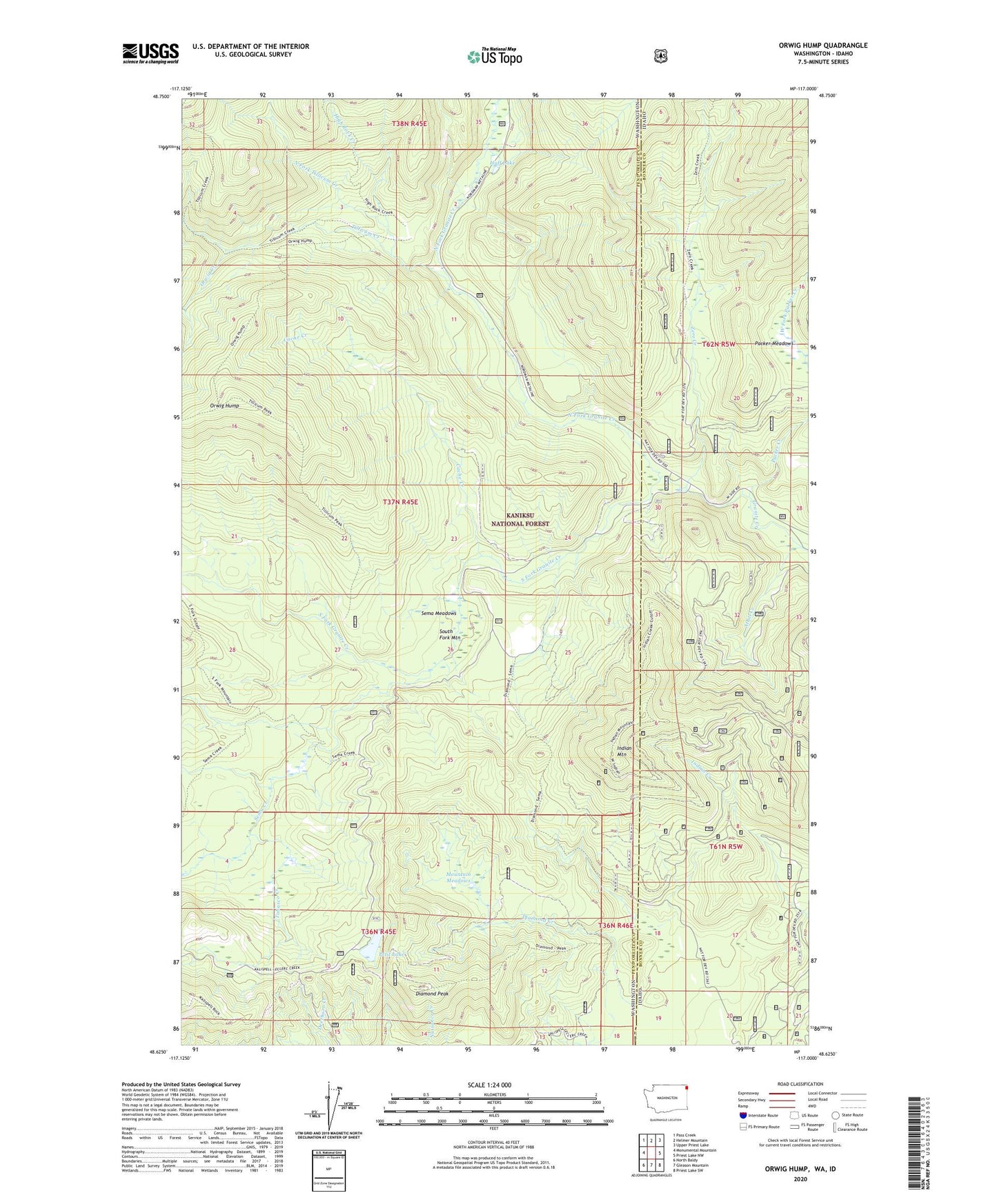
2020 topographic map quadrangle Orwig Hump in the states of Washington, Idaho. Scale: 1:24000. Based on the newly updated USGS 7.5' US Topo map series, this map is in the following counties: Pend Oreille, Bonner. The map contains contour data, water features, and other items you are used to seeing on USGS maps, but also has updated roads and other features. This is the next generation of topographic maps. Printed on high-quality waterproof paper with UV fade-resistant inks.
Quads adjacent to this one:
West: Monumental Mountain
Northwest: Pass Creek
North: Helmer Mountain
Northeast: Upper Priest Lake
East: Priest Lake NW
Southeast: Priest Lake SW
South: Gleason Mountain
Southwest: North Baldy
Contains the following named places: Athol Creek, Cache Creek, Diamond Creek, Diamond Peak, High Rock Creek, Huff Lake, Indian Creek, Indian Mountain, Indian Mountain Lookout, Indian Mountain Lookout Tower, Mountain Meadows, North Fork Granite Creek, North Fork Tillicum Creek, Orwig Creek, Orwig Hump, Orwig Hump Lookout, Packer Creek, Packer Meadows, Petit Lake, Petit Lake Access Recreation Area, Petit Lake Campground, Sema Creek, Sema Meadows, South Fork Granite Creek, Tillicum Creek, Tobasco Creek, Zero Creek