MyTopo
Gleason Mountain Washington US Topo Map
Couldn't load pickup availability
Also explore the Gleason Mountain Forest Service Topo of this same quad for updated USFS data
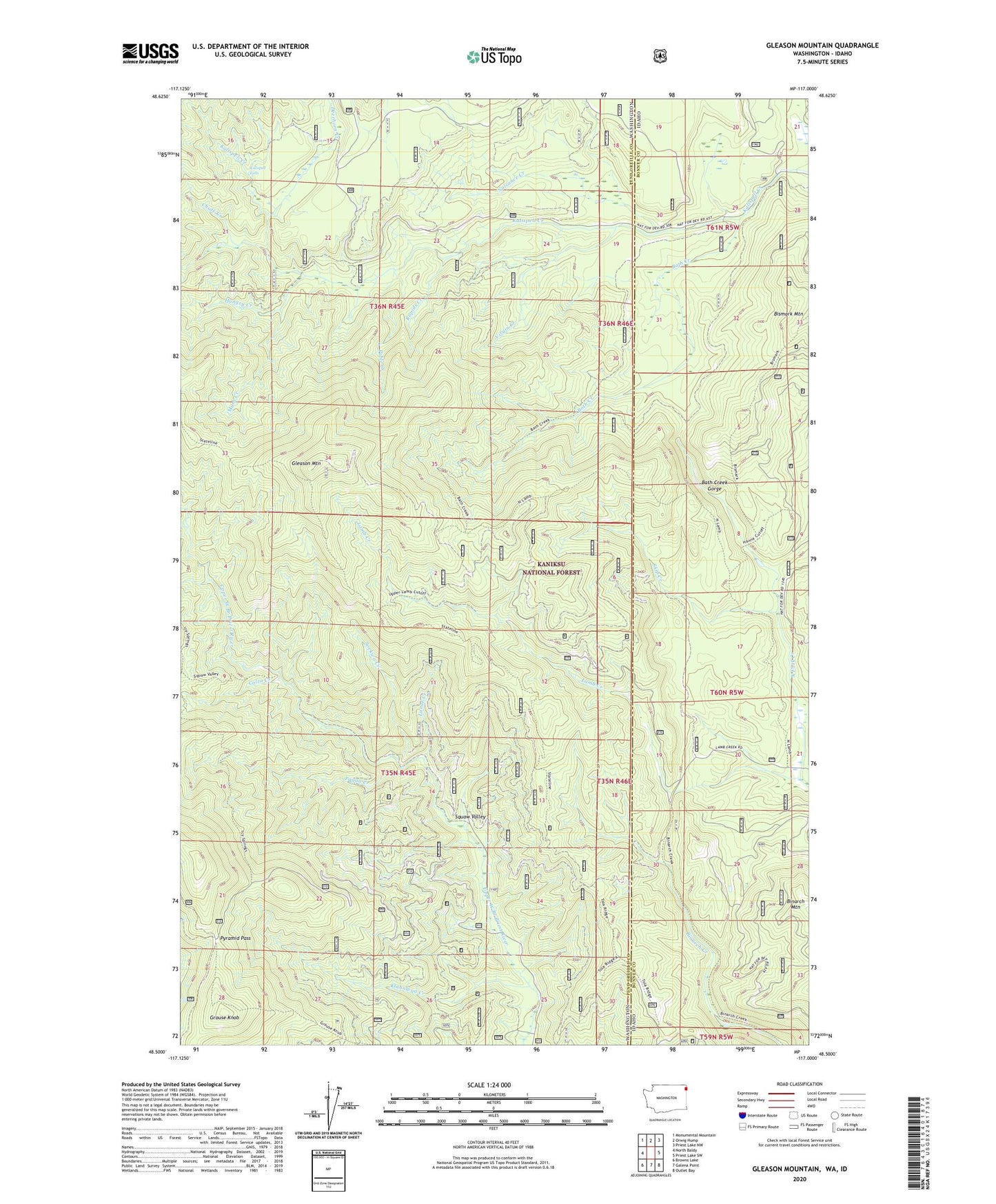
2023 topographic map quadrangle Gleason Mountain in the states of Washington, Idaho. Scale: 1:24000. Based on the newly updated USGS 7.5' US Topo map series, this map is in the following counties: Pend Oreille, Bonner. The map contains contour data, water features, and other items you are used to seeing on USGS maps, but also has updated roads and other features. This is the next generation of topographic maps. Printed on high-quality waterproof paper with UV fade-resistant inks.
Quads adjacent to this one:
West: North Baldy
Northwest: Monumental Mountain
North: Orwig Hump
Northeast: Priest Lake NW
East: Priest Lake SW
Southeast: Outlet Bay
South: Galena Point
Southwest: Browns Lake
This map covers the same area as the classic USGS quad with code o48117e1.
Contains the following named places: Bath Creek, Bath Creek Gorge, Chute Creek, Colza Creek, Deerhorn Creek, Gleason Mountain, Grouse Knob, Hungry Creek, Kalispell Falls, Klahowya Creek, Last Chance Mine, Lunar Creek, Mush Creek, North Fork Creek, Nuisance Creek, Pable Creek, Paqua Creek, Pyramid Pass, Rapids Creek, Skip Creek, Sockwa Creek, Virgin Creek