MyTopo
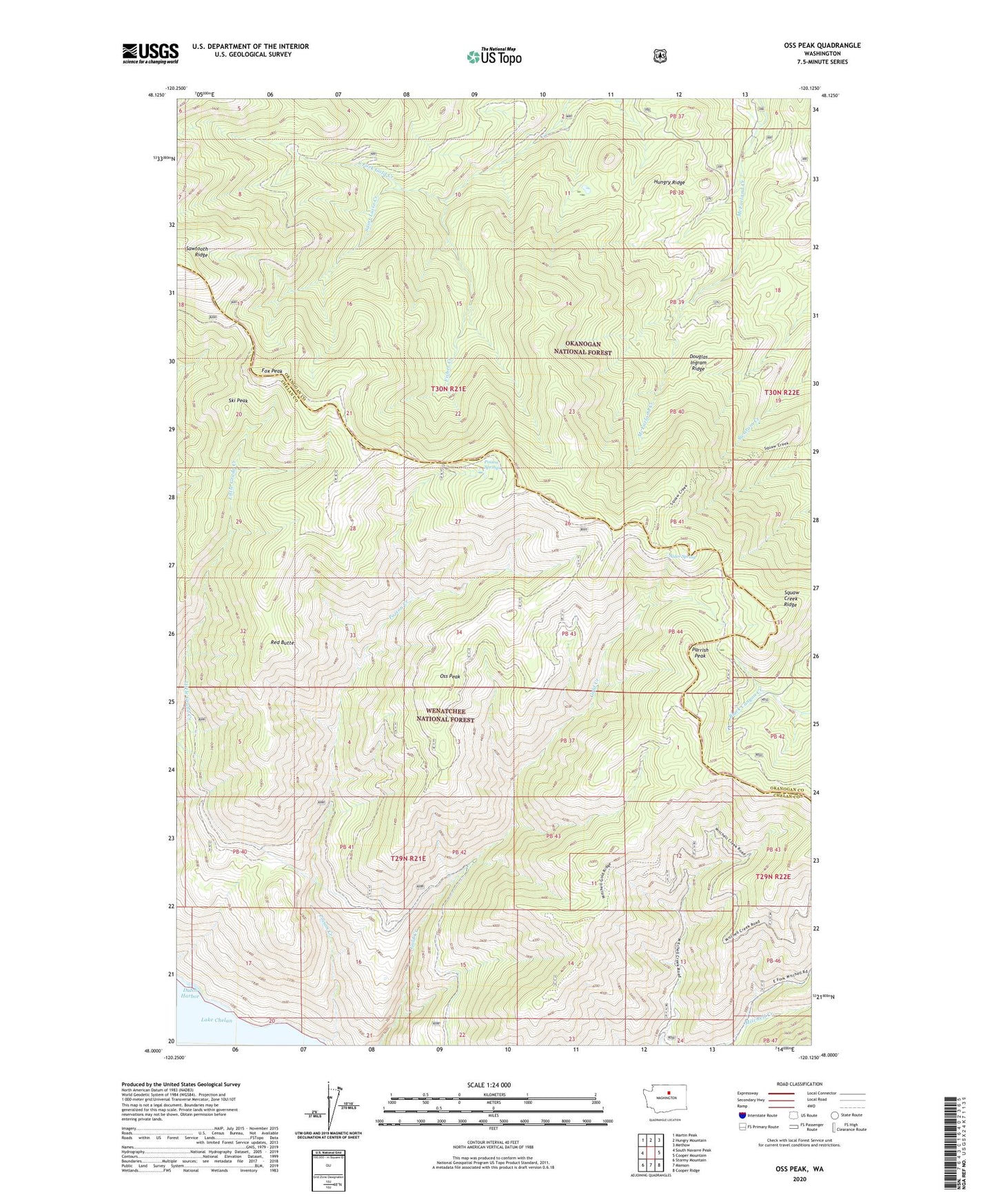
Oss Peak Washington US Topo Map
Couldn't load pickup availability
Also explore the Oss Peak Forest Service Topo of this same quad for updated USFS data
2023 topographic map quadrangle Oss Peak in the state of Washington. Scale: 1:24000. Based on the newly updated USGS 7.5' US Topo map series, this map is in the following counties: Chelan, Okanogan. The map contains contour data, water features, and other items you are used to seeing on USGS maps, but also has updated roads and other features. This is the next generation of topographic maps. Printed on high-quality waterproof paper with UV fade-resistant inks.
Quads adjacent to this one:
West: South Navarre Peak
Northwest: Martin Peak
North: Hungry Mountain
Northeast: Methow
East: Cooper Mountain
Southeast: Cooper Ridge
South: Manson
Southwest: Stormy Mountain
This map covers the same area as the classic USGS quad with code o48120a2.
Contains the following named places: Alder Spring, Camp Four, Douglas Ingram Ridge, Dutch Harbor, Fisher Creek, Fox Peak, Hungry Ridge, Oss Peak, Parrish Peak, Poison Creek, Poison Creek Campground, Poison Springs, Red Butte, Saint Luise Creek, Ski Peak, Squaw Creek Ridge