MyTopo
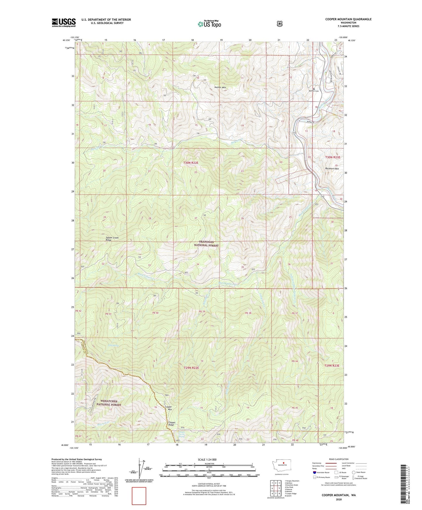
Cooper Mountain Washington US Topo Map
Couldn't load pickup availability
Also explore the Cooper Mountain Forest Service Topo of this same quad for updated USFS data
2023 topographic map quadrangle Cooper Mountain in the state of Washington. Scale: 1:24000. Based on the newly updated USGS 7.5' US Topo map series, this map is in the following counties: Okanogan, Chelan. The map contains contour data, water features, and other items you are used to seeing on USGS maps, but also has updated roads and other features. This is the next generation of topographic maps. Printed on high-quality waterproof paper with UV fade-resistant inks.
Quads adjacent to this one:
West: Oss Peak
Northwest: Hungry Mountain
North: Methow
Northeast: Knowlton Knob
East: Pateros
Southeast: Azwell
South: Cooper Ridge
Southwest: Manson
This map covers the same area as the classic USGS quad with code o48120a1.
Contains the following named places: Black Canyon, Black Canyon Creek, Cooper Corral Spring, Cooper Mountain, Cooper Ridge, Gold Spring, Hunter Mountain, Left Fork, Left Fork Black Canyon Creek, Little Joe Creek, Methow Cemetery, Squaw Creek Guard Station, Swaram Creek, Woody Creek, ZIP Code: 98834