
MyTopo
Outlet Falls Washington US Topo Map
Couldn't load pickup availability
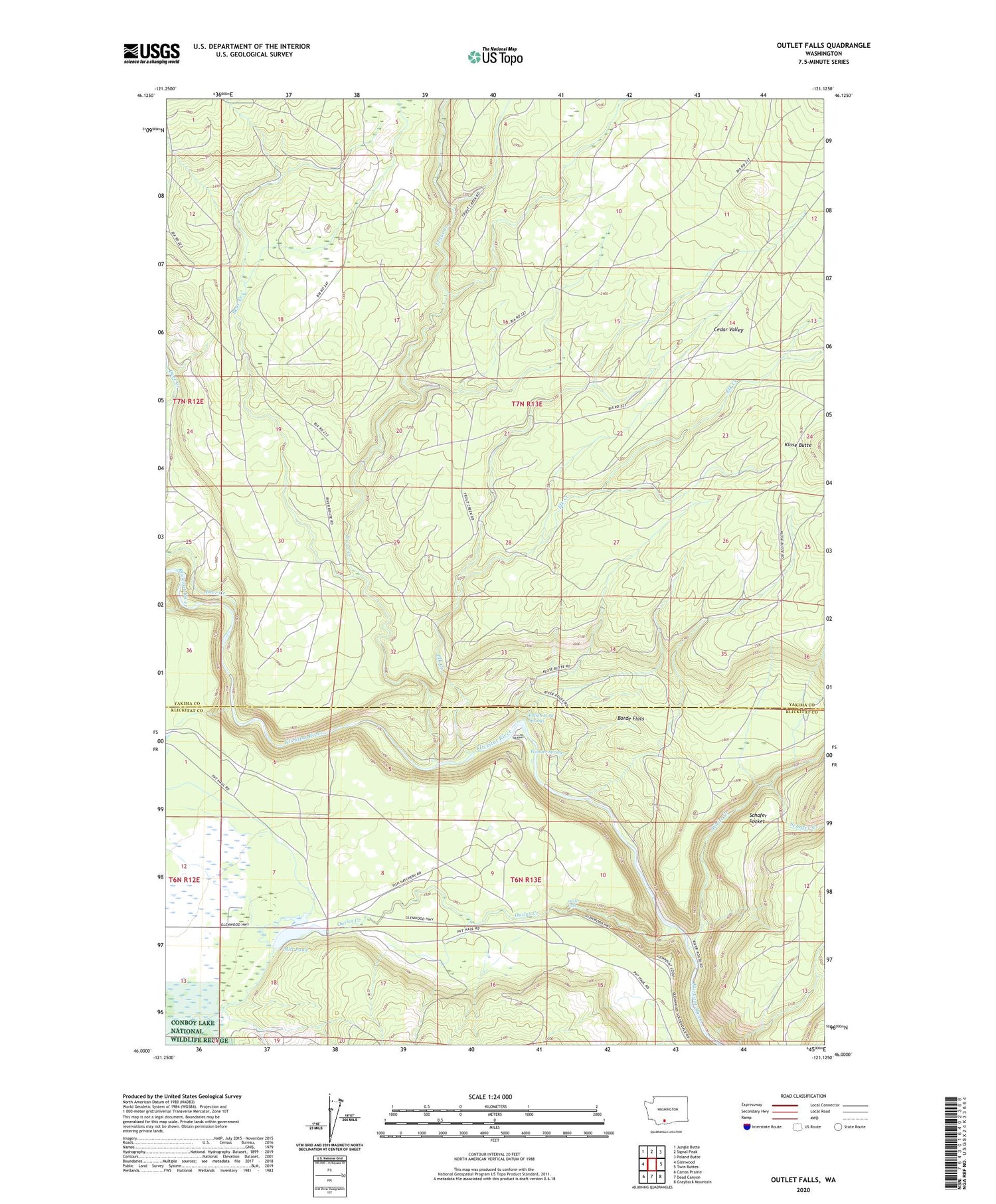
2020 topographic map quadrangle Outlet Falls in the state of Washington. Scale: 1:24000. Based on the newly updated USGS 7.5' US Topo map series, this map is in the following counties: Yakima, Klickitat. The map contains contour data, water features, and other items you are used to seeing on USGS maps, but also has updated roads and other features. This is the next generation of topographic maps. Printed on high-quality waterproof paper with UV fade-resistant inks.
Quads adjacent to this one:
West: Glenwood
Northwest: Jungle Butte
North: Signal Peak
Northeast: Poland Butte
East: Twin Buttes
Southeast: Grayback Mountain
South: Dead Canyon
Southwest: Camas Prairie
Contains the following named places: Bear Creek, Borde Flats, Cedar Valley, Deer Creek, Elk Creek, Indian Ford Springs, Klickitat State Fish Hatchery, Mill Pond, Mill Pond Dam, Outlet Creek, Outlet Creek Campground, Outlet Falls, Schafer Creek, Schafer Pocket, Skunk Creek, Trout Creek, White Creek, Wonder Spring


